SHUM AZ.SHUM - Earthquake Result Viewer
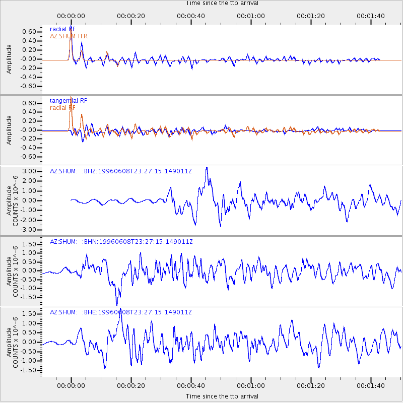
Earthquake location: Andreanof Islands, Aleutian Is.
Earthquake latitude/longitude: 51.5/-178.1
Earthquake time(UTC): 1996/06/08 (160) 23:19:15 GMT
Earthquake Depth: 33 km
Earthquake Magnitude: 5.9 MB, 6.3 MS, 6.5 UNKNOWN, 6.1 MS
Earthquake Catalog/Contributor: WHDF/NEIC
Network: AZ ANZA Regional Network
Station: SHUM AZ.SHUM
Lat/Lon: 33.63 N/116.44 W
Elevation: 1195 m
Distance: 47.3 deg
Az: 87.21 deg
Baz: 311.542 deg
Ray Param: 0.069990136
Estimated Moho Depth: 30.0 km
Estimated Crust Vp/Vs: 1.71
Assumed Crust Vp: 6.264 km/s
Estimated Crust Vs: 3.663 km/s
Estimated Crust Poisson's Ratio: 0.24
Radial Match: 89.44737 %
Radial Bump: 400
Transverse Match: 81.00835 %
Transverse Bump: 400
SOD ConfigId: 6273
Insert Time: 2010-02-26 20:40:46.797 +0000
GWidth: 2.5
Max Bumps: 400
Tol: 0.001

Signal To Noise

ChannelStoNSTALTA
AZ:SHUM: :BHN:19960608T23:27:15.149011Z1.93780761.9986959E-71.0314212E-7
AZ:SHUM: :BHE:19960608T23:27:15.149011Z2.04980783.282361E-71.6013018E-7
AZ:SHUM: :BHZ:19960608T23:27:15.149011Z3.5790555.8505395E-71.6346605E-7
Arrivals
Ps3.6 SECOND
PpPs12 SECOND
PsPs/PpSs16 SECOND