You are here: Home > Network List > US - United States National Seismic Network Stations List
> Station MNTX Cornudas Mountains, Texas, USA > Earthquake Result Viewer
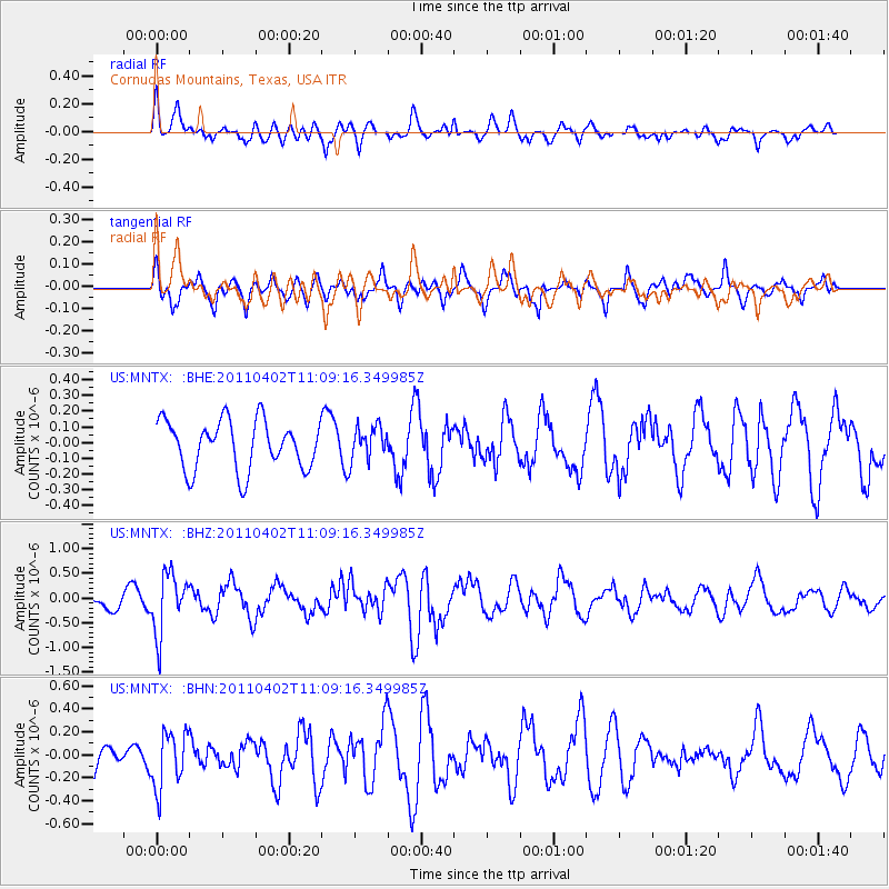
MNTX Cornudas Mountains, Texas, USA - Earthquake Result Viewer
*The percent match for this event was below the threshold and hence no stack was calculated.
| Earthquake location: |
Northern Chile |
| Earthquake latitude/longitude: |
-19.6/-69.1 |
| Earthquake time(UTC): |
2011/04/02 (092) 10:59:37 GMT |
| Earthquake Depth: |
84 km |
| Earthquake Magnitude: |
6.0 MB, 5.9 MW, 5.9 MW |
| Earthquake Catalog/Contributor: |
WHDF/NEIC |
|
| Network: |
US United States National Seismic Network |
| Station: |
MNTX Cornudas Mountains, Texas, USA |
| Lat/Lon: |
31.70 N/105.38 W |
| Elevation: |
404 m |
|
| Distance: |
61.7 deg |
| Az: |
325.03 deg |
| Baz: |
140.654 deg |
| Ray Param: |
$rayparam |
*The percent match for this event was below the threshold and hence was not used in the summary stack. |
|
| Radial Match: |
58.666065 % |
| Radial Bump: |
400 |
| Transverse Match: |
67.03177 % |
| Transverse Bump: |
375 |
| SOD ConfigId: |
356183 |
| Insert Time: |
2011-09-23 10:59:17.609 +0000 |
| GWidth: |
2.5 |
| Max Bumps: |
400 |
| Tol: |
0.001 |
|
Signal To Noise
| Channel | StoN | STA | LTA |
| US:MNTX: :BHZ:20110402T11:09:16.349985Z | 2.5088248 | 6.059961E-7 | 2.415458E-7 |
| US:MNTX: :BHN:20110402T11:09:16.349985Z | 1.3773514 | 2.448995E-7 | 1.7780465E-7 |
| US:MNTX: :BHE:20110402T11:09:16.349985Z | 0.6928309 | 1.0769526E-7 | 1.5544234E-7 |
| Arrivals |
| Ps | |
| PpPs | |
| PsPs/PpSs | |


