SHUM AZ.SHUM - Earthquake Result Viewer
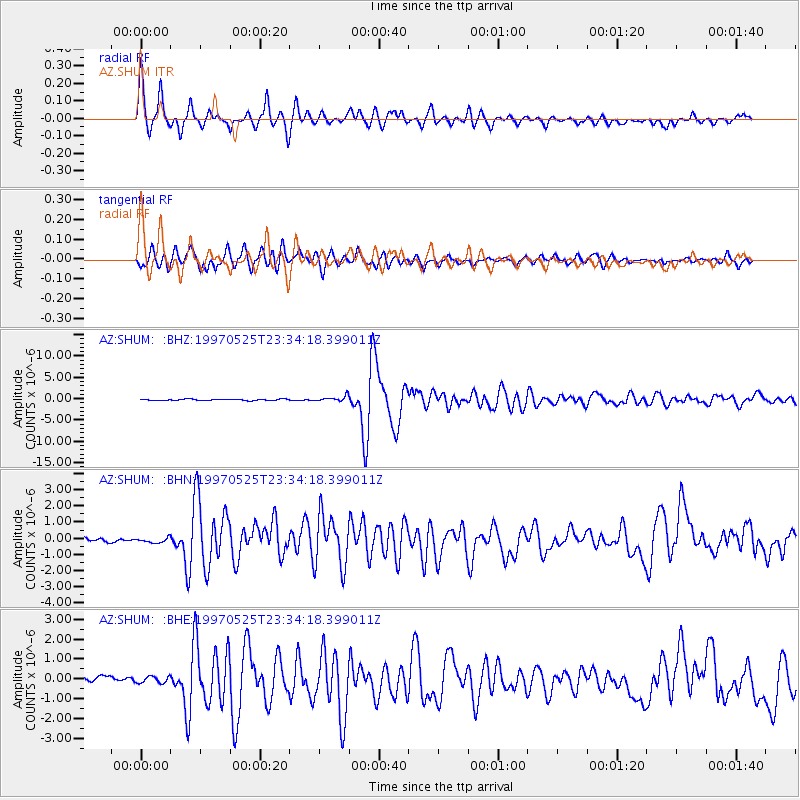
Earthquake location: South Of Kermadec Islands
Earthquake latitude/longitude: -32.1/179.8
Earthquake time(UTC): 1997/05/25 (145) 23:22:33 GMT
Earthquake Depth: 333 km
Earthquake Magnitude: 6.2 MB, 7.1 UNKNOWN, 7.0 MW
Earthquake Catalog/Contributor: WHDF/NEIC
Network: AZ ANZA Regional Network
Station: SHUM AZ.SHUM
Lat/Lon: 33.63 N/116.44 W
Elevation: 1195 m
Distance: 88.8 deg
Az: 48.464 deg
Baz: 229.582 deg
Ray Param: 0.04171229
Estimated Moho Depth: 26.75 km
Estimated Crust Vp/Vs: 1.78
Assumed Crust Vp: 6.264 km/s
Estimated Crust Vs: 3.514 km/s
Estimated Crust Poisson's Ratio: 0.27
Radial Match: 90.7395 %
Radial Bump: 359
Transverse Match: 81.07867 %
Transverse Bump: 400
SOD ConfigId: 9875
Insert Time: 2010-02-26 20:40:53.900 +0000
GWidth: 2.5
Max Bumps: 400
Tol: 0.001

Signal To Noise

ChannelStoNSTALTA
AZ:SHUM: :BHN:19970525T23:34:18.399011Z1.25265191.434619E-71.1452655E-7
AZ:SHUM: :BHE:19970525T23:34:18.399011Z0.66332981.750759E-72.6393494E-7
AZ:SHUM: :BHZ:19970525T23:34:18.399011Z4.18253146.3528785E-71.5189075E-7
Arrivals
Ps3.4 SECOND
PpPs12 SECOND
PsPs/PpSs15 SECOND