You are here: Home > Network List > AZ - ANZA Regional Network Stations List
> Station SHUM AZ.SHUM > Earthquake Result Viewer
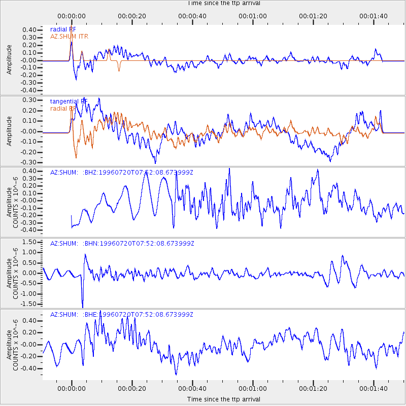
SHUM AZ.SHUM - Earthquake Result Viewer
*The percent match for this event was below the threshold and hence no stack was calculated.
| Earthquake location: |
Fiji Islands Region |
| Earthquake latitude/longitude: |
-19.8/-177.6 |
| Earthquake time(UTC): |
1996/07/20 (202) 07:41:15 GMT |
| Earthquake Depth: |
357 km |
| Earthquake Magnitude: |
5.7 MB, 5.9 UNKNOWN, 5.8 MW |
| Earthquake Catalog/Contributor: |
WHDF/NEIC |
|
| Network: |
AZ ANZA Regional Network |
| Station: |
SHUM AZ.SHUM |
| Lat/Lon: |
33.63 N/116.44 W |
| Elevation: |
1195 m |
|
| Distance: |
78.9 deg |
| Az: |
48.164 deg |
| Baz: |
237.221 deg |
| Ray Param: |
$rayparam |
*The percent match for this event was below the threshold and hence was not used in the summary stack. |
|
| Radial Match: |
46.501415 % |
| Radial Bump: |
400 |
| Transverse Match: |
41.954163 % |
| Transverse Bump: |
400 |
| SOD ConfigId: |
4480 |
| Insert Time: |
2010-02-26 20:41:08.381 +0000 |
| GWidth: |
2.5 |
| Max Bumps: |
400 |
| Tol: |
0.001 |
|
Signal To Noise
| Channel | StoN | STA | LTA |
| AZ:SHUM: :BHN:19960720T07:52:08.673999Z | 4.585296 | 5.339638E-7 | 1.1645133E-7 |
| AZ:SHUM: :BHE:19960720T07:52:08.673999Z | 1.0283374 | 1.4061321E-7 | 1.367384E-7 |
| AZ:SHUM: :BHZ:19960720T07:52:08.673999Z | 1.6515166 | 2.8880143E-7 | 1.7487045E-7 |
| Arrivals |
| Ps | |
| PpPs | |
| PsPs/PpSs | |


