You are here: Home > Network List > AZ - ANZA Regional Network Stations List
> Station SHUM AZ.SHUM > Earthquake Result Viewer
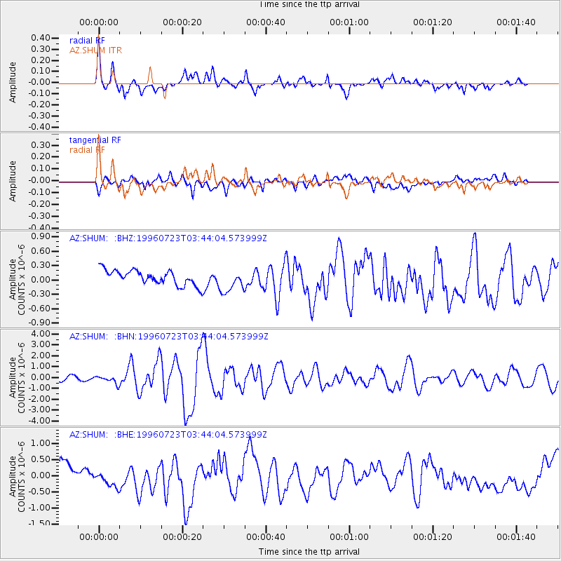
SHUM AZ.SHUM - Earthquake Result Viewer
*The percent match for this event was below the threshold and hence no stack was calculated.
| Earthquake location: |
South Of Fiji Islands |
| Earthquake latitude/longitude: |
-26.8/-177.2 |
| Earthquake time(UTC): |
1996/07/23 (205) 03:32:12 GMT |
| Earthquake Depth: |
33 km |
| Earthquake Magnitude: |
5.8 MB, 6.4 MS, 6.5 UNKNOWN, 6.5 MW |
| Earthquake Catalog/Contributor: |
WHDF/NEIC |
|
| Network: |
AZ ANZA Regional Network |
| Station: |
SHUM AZ.SHUM |
| Lat/Lon: |
33.63 N/116.44 W |
| Elevation: |
1195 m |
|
| Distance: |
83.2 deg |
| Az: |
47.143 deg |
| Baz: |
231.78 deg |
| Ray Param: |
$rayparam |
*The percent match for this event was below the threshold and hence was not used in the summary stack. |
|
| Radial Match: |
77.18416 % |
| Radial Bump: |
400 |
| Transverse Match: |
52.190823 % |
| Transverse Bump: |
400 |
| SOD ConfigId: |
4480 |
| Insert Time: |
2010-02-26 20:41:09.073 +0000 |
| GWidth: |
2.5 |
| Max Bumps: |
400 |
| Tol: |
0.001 |
|
Signal To Noise
| Channel | StoN | STA | LTA |
| AZ:SHUM: :BHN:19960723T03:44:04.573999Z | 2.3349097 | 3.668107E-7 | 1.5709844E-7 |
| AZ:SHUM: :BHE:19960723T03:44:04.573999Z | 0.6416161 | 2.815537E-7 | 4.3881957E-7 |
| AZ:SHUM: :BHZ:19960723T03:44:04.573999Z | 1.597042 | 2.4383417E-7 | 1.5267862E-7 |
| Arrivals |
| Ps | |
| PpPs | |
| PsPs/PpSs | |


