You are here: Home > Network List > AZ - ANZA Regional Network Stations List
> Station SHUM AZ.SHUM > Earthquake Result Viewer
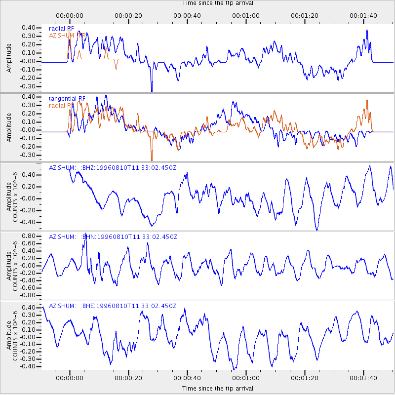
SHUM AZ.SHUM - Earthquake Result Viewer
*The percent match for this event was below the threshold and hence no stack was calculated.
| Earthquake location: |
New Britain Region, P.N.G. |
| Earthquake latitude/longitude: |
-4.9/152.1 |
| Earthquake time(UTC): |
1996/08/10 (223) 11:20:19 GMT |
| Earthquake Depth: |
33 km |
| Earthquake Magnitude: |
5.6 MB, 6.0 MS, 6.2 UNKNOWN, 6.1 MW |
| Earthquake Catalog/Contributor: |
WHDF/NEIC |
|
| Network: |
AZ ANZA Regional Network |
| Station: |
SHUM AZ.SHUM |
| Lat/Lon: |
33.63 N/116.44 W |
| Elevation: |
1195 m |
|
| Distance: |
93.9 deg |
| Az: |
56.718 deg |
| Baz: |
266.685 deg |
| Ray Param: |
$rayparam |
*The percent match for this event was below the threshold and hence was not used in the summary stack. |
|
| Radial Match: |
62.644493 % |
| Radial Bump: |
400 |
| Transverse Match: |
41.90372 % |
| Transverse Bump: |
400 |
| SOD ConfigId: |
4480 |
| Insert Time: |
2010-02-26 20:41:10.811 +0000 |
| GWidth: |
2.5 |
| Max Bumps: |
400 |
| Tol: |
0.001 |
|
Signal To Noise
| Channel | StoN | STA | LTA |
| AZ:SHUM: :BHN:19960810T11:33:02.450Z | 1.2966884 | 2.0892652E-7 | 1.6112315E-7 |
| AZ:SHUM: :BHE:19960810T11:33:02.450Z | 0.9212048 | 3.297956E-7 | 3.5800466E-7 |
| AZ:SHUM: :BHZ:19960810T11:33:02.450Z | 1.2638965 | 2.5003172E-7 | 1.978261E-7 |
| Arrivals |
| Ps | |
| PpPs | |
| PsPs/PpSs | |


