You are here: Home > Network List > AZ - ANZA Regional Network Stations List
> Station SHUM AZ.SHUM > Earthquake Result Viewer
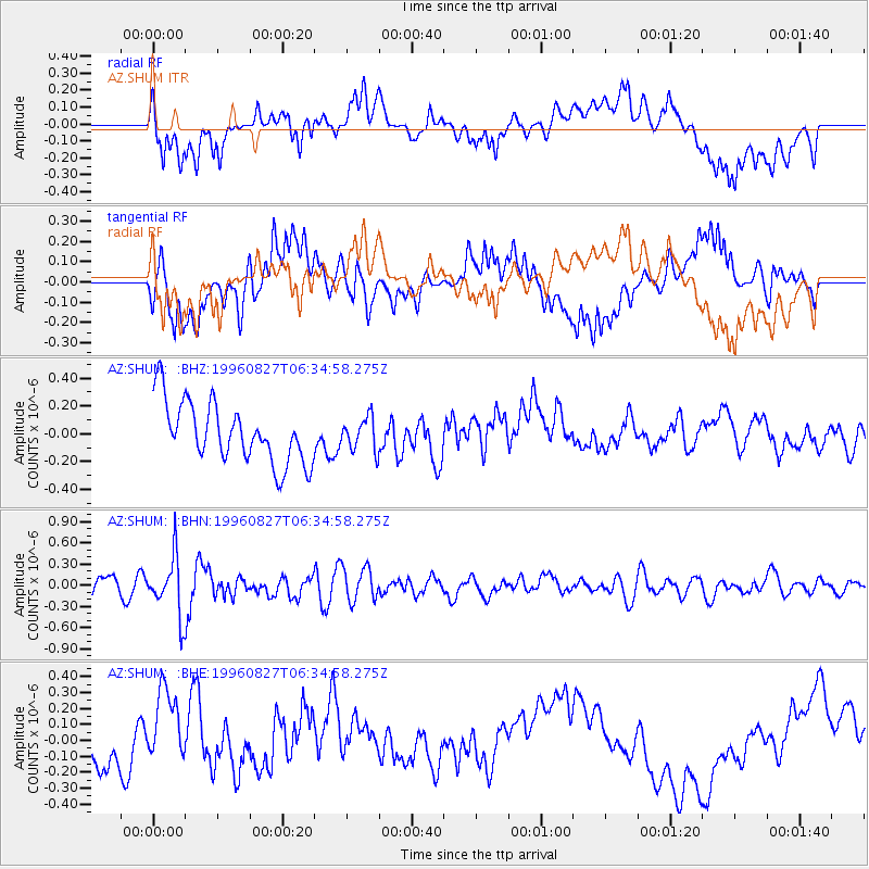
SHUM AZ.SHUM - Earthquake Result Viewer
*The percent match for this event was below the threshold and hence no stack was calculated.
| Earthquake location: |
South Of Fiji Islands |
| Earthquake latitude/longitude: |
-22.6/-179.8 |
| Earthquake time(UTC): |
1996/08/27 (240) 06:24:07 GMT |
| Earthquake Depth: |
575 km |
| Earthquake Magnitude: |
5.6 MB, 6.0 UNKNOWN, 5.5 MB |
| Earthquake Catalog/Contributor: |
WHDF/NEIC |
|
| Network: |
AZ ANZA Regional Network |
| Station: |
SHUM AZ.SHUM |
| Lat/Lon: |
33.63 N/116.44 W |
| Elevation: |
1195 m |
|
| Distance: |
82.2 deg |
| Az: |
48.817 deg |
| Baz: |
236.491 deg |
| Ray Param: |
$rayparam |
*The percent match for this event was below the threshold and hence was not used in the summary stack. |
|
| Radial Match: |
48.280556 % |
| Radial Bump: |
400 |
| Transverse Match: |
59.496677 % |
| Transverse Bump: |
400 |
| SOD ConfigId: |
4480 |
| Insert Time: |
2010-02-26 20:41:22.503 +0000 |
| GWidth: |
2.5 |
| Max Bumps: |
400 |
| Tol: |
0.001 |
|
Signal To Noise
| Channel | StoN | STA | LTA |
| AZ:SHUM: :BHN:19960827T06:34:58.275Z | 3.7070575 | 4.1151924E-7 | 1.11009676E-7 |
| AZ:SHUM: :BHE:19960827T06:34:58.275Z | 1.722993 | 2.8720316E-7 | 1.6668852E-7 |
| AZ:SHUM: :BHZ:19960827T06:34:58.275Z | 0.54387236 | 1.1839521E-7 | 2.1768932E-7 |
| Arrivals |
| Ps | |
| PpPs | |
| PsPs/PpSs | |


