
DGAR Diego Garcia, Chagos Islands, Indian Ocean - Earthquake Result Viewer
| ||||||||||||||||||
| ||||||||||||||||||
| ||||||||||||||||||
|
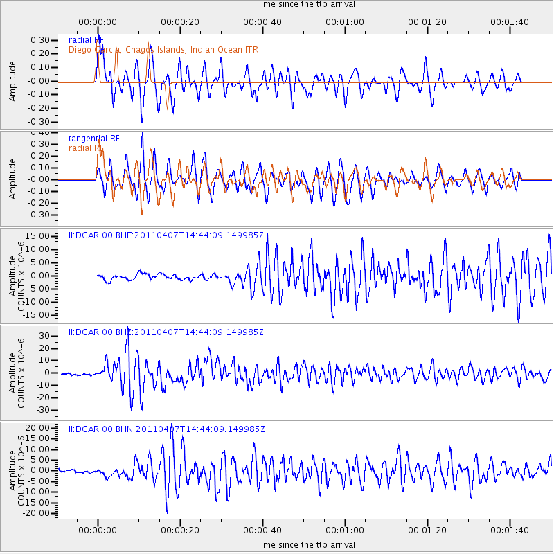
Signal To Noise
| Channel | StoN | STA | LTA |
| II:DGAR:00:BHZ:20110407T14:44:09.149985Z | 9.0020275 | 6.0117886E-6 | 6.6782604E-7 |
| II:DGAR:00:BHN:20110407T14:44:09.149985Z | 1.9487005 | 1.6569983E-6 | 8.5030933E-7 |
| II:DGAR:00:BHE:20110407T14:44:09.149985Z | 1.567611 | 1.6361504E-6 | 1.0437222E-6 |
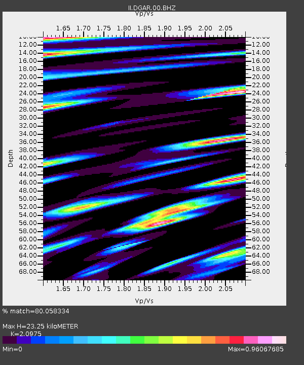
| Arrivals | |
| Ps | 4.9 SECOND |
| PpPs | 13 SECOND |
| PsPs/PpSs | 18 SECOND |

