You are here: Home > Network List > AZ - ANZA Regional Network Stations List
> Station SHUM AZ.SHUM > Earthquake Result Viewer
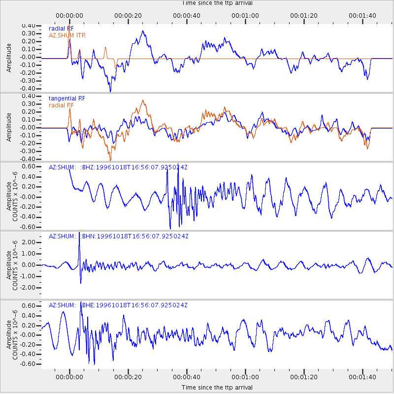
SHUM AZ.SHUM - Earthquake Result Viewer
*The percent match for this event was below the threshold and hence no stack was calculated.
| Earthquake location: |
Near S. Coast Of Honshu, Japan |
| Earthquake latitude/longitude: |
33.7/137.4 |
| Earthquake time(UTC): |
1996/10/18 (292) 16:44:47 GMT |
| Earthquake Depth: |
338 km |
| Earthquake Magnitude: |
5.6 UNKNOWN, 5.4 MB, 5.6 MW |
| Earthquake Catalog/Contributor: |
WHDF/NEIC |
|
| Network: |
AZ ANZA Regional Network |
| Station: |
SHUM AZ.SHUM |
| Lat/Lon: |
33.63 N/116.44 W |
| Elevation: |
1195 m |
|
| Distance: |
83.6 deg |
| Az: |
53.74 deg |
| Baz: |
306.307 deg |
| Ray Param: |
$rayparam |
*The percent match for this event was below the threshold and hence was not used in the summary stack. |
|
| Radial Match: |
27.313766 % |
| Radial Bump: |
400 |
| Transverse Match: |
41.499397 % |
| Transverse Bump: |
400 |
| SOD ConfigId: |
4480 |
| Insert Time: |
2010-02-26 20:41:34.764 +0000 |
| GWidth: |
2.5 |
| Max Bumps: |
400 |
| Tol: |
0.001 |
|
Signal To Noise
| Channel | StoN | STA | LTA |
| AZ:SHUM: :BHN:19961018T16:56:07.925024Z | 5.414716 | 7.510534E-7 | 1.3870597E-7 |
| AZ:SHUM: :BHE:19961018T16:56:07.925024Z | 1.0743995 | 3.383236E-7 | 3.1489552E-7 |
| AZ:SHUM: :BHZ:19961018T16:56:07.925024Z | 1.6204816 | 2.486084E-7 | 1.5341635E-7 |
| Arrivals |
| Ps | |
| PpPs | |
| PsPs/PpSs | |


