TIP Timpagrande, Italy - Earthquake Result Viewer
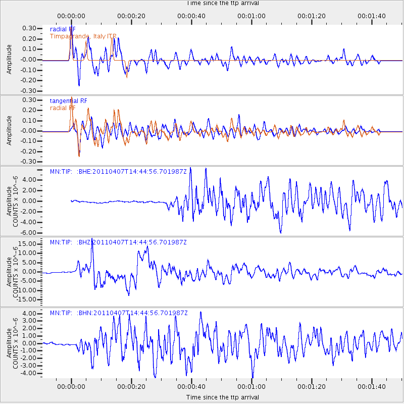
Earthquake location: Near East Coast Of Honshu, Japan
Earthquake latitude/longitude: 38.3/141.6
Earthquake time(UTC): 2011/04/07 (097) 14:32:43 GMT
Earthquake Depth: 42 km
Earthquake Magnitude: 6.9 MB, 7.0 MS, 7.1 MW, 7.1 MW
Earthquake Catalog/Contributor: WHDF/NEIC
Network: MN MEDNET Project
Station: TIP Timpagrande, Italy
Lat/Lon: 39.18 N/16.76 E
Elevation: 789 m
Distance: 87.8 deg
Az: 320.321 deg
Baz: 40.281 deg
Ray Param: 0.04301244
Estimated Moho Depth: 33.25 km
Estimated Crust Vp/Vs: 1.68
Assumed Crust Vp: 6.1 km/s
Estimated Crust Vs: 3.636 km/s
Estimated Crust Poisson's Ratio: 0.22
Radial Match: 93.16891 %
Radial Bump: 400
Transverse Match: 89.49531 %
Transverse Bump: 400
SOD ConfigId: 356183
Insert Time: 2011-09-23 13:34:09.707 +0000
GWidth: 2.5
Max Bumps: 400
Tol: 0.001

Signal To Noise

ChannelStoNSTALTA
MN:TIP: :BHZ:20110407T14:44:56.701987Z17.5153732.4995288E-61.4270485E-7
MN:TIP: :BHN:20110407T14:44:56.701987Z3.75213485.071787E-71.3517071E-7
MN:TIP: :BHE:20110407T14:44:56.701987Z4.3169935.7902645E-71.3412726E-7
Arrivals
Ps3.8 SECOND
PpPs14 SECOND
PsPs/PpSs18 SECOND