You are here: Home > Network List > AZ - ANZA Regional Network Stations List
> Station SHUM AZ.SHUM > Earthquake Result Viewer
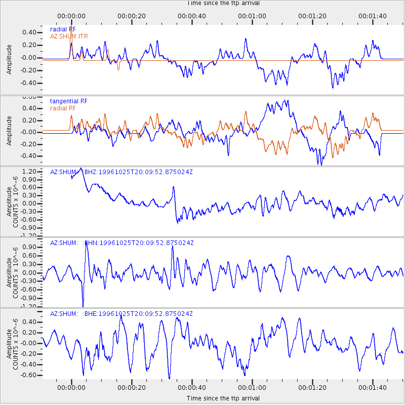
SHUM AZ.SHUM - Earthquake Result Viewer
*The percent match for this event was below the threshold and hence no stack was calculated.
| Earthquake location: |
Peru-Bolivia Border Region |
| Earthquake latitude/longitude: |
-17.4/-70.0 |
| Earthquake time(UTC): |
1996/10/25 (299) 19:59:41 GMT |
| Earthquake Depth: |
116 km |
| Earthquake Magnitude: |
5.5 MB, 5.7 UNKNOWN, 5.6 MW |
| Earthquake Catalog/Contributor: |
WHDF/NEIC |
|
| Network: |
AZ ANZA Regional Network |
| Station: |
SHUM AZ.SHUM |
| Lat/Lon: |
33.63 N/116.44 W |
| Elevation: |
1195 m |
|
| Distance: |
67.3 deg |
| Az: |
319.056 deg |
| Baz: |
131.405 deg |
| Ray Param: |
$rayparam |
*The percent match for this event was below the threshold and hence was not used in the summary stack. |
|
| Radial Match: |
22.592875 % |
| Radial Bump: |
400 |
| Transverse Match: |
24.953161 % |
| Transverse Bump: |
400 |
| SOD ConfigId: |
4480 |
| Insert Time: |
2010-02-26 20:41:37.304 +0000 |
| GWidth: |
2.5 |
| Max Bumps: |
400 |
| Tol: |
0.001 |
|
Signal To Noise
| Channel | StoN | STA | LTA |
| AZ:SHUM: :BHN:19961025T20:09:52.875024Z | 3.5311358 | 4.135914E-7 | 1.1712702E-7 |
| AZ:SHUM: :BHE:19961025T20:09:52.875024Z | 1.4631929 | 2.964765E-7 | 2.0262296E-7 |
| AZ:SHUM: :BHZ:19961025T20:09:52.875024Z | 1.1674263 | 4.6827006E-7 | 4.0111314E-7 |
| Arrivals |
| Ps | |
| PpPs | |
| PsPs/PpSs | |


