You are here: Home > Network List > AZ - ANZA Regional Network Stations List
> Station SHUM AZ.SHUM > Earthquake Result Viewer
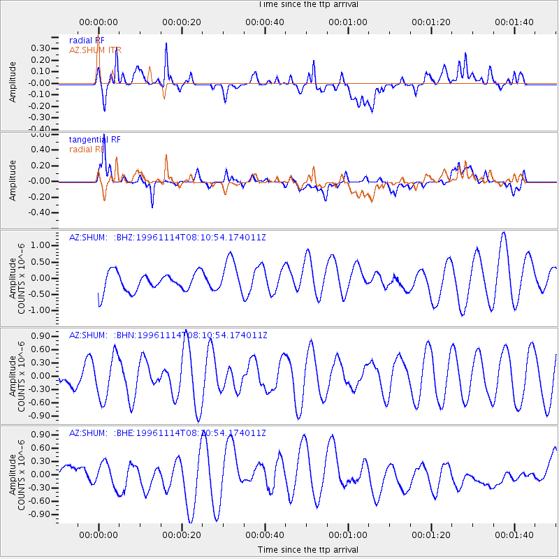
SHUM AZ.SHUM - Earthquake Result Viewer
*The percent match for this event was below the threshold and hence no stack was calculated.
| Earthquake location: |
Santa Cruz Islands |
| Earthquake latitude/longitude: |
-11.4/166.5 |
| Earthquake time(UTC): |
1996/11/14 (319) 07:58:58 GMT |
| Earthquake Depth: |
109 km |
| Earthquake Magnitude: |
5.7 MB |
| Earthquake Catalog/Contributor: |
WHDF/NEIC |
|
| Network: |
AZ ANZA Regional Network |
| Station: |
SHUM AZ.SHUM |
| Lat/Lon: |
33.63 N/116.44 W |
| Elevation: |
1195 m |
|
| Distance: |
85.7 deg |
| Az: |
54.638 deg |
| Baz: |
253.432 deg |
| Ray Param: |
$rayparam |
*The percent match for this event was below the threshold and hence was not used in the summary stack. |
|
| Radial Match: |
55.71333 % |
| Radial Bump: |
400 |
| Transverse Match: |
56.174263 % |
| Transverse Bump: |
400 |
| SOD ConfigId: |
4480 |
| Insert Time: |
2010-02-26 20:41:41.544 +0000 |
| GWidth: |
2.5 |
| Max Bumps: |
400 |
| Tol: |
0.001 |
|
Signal To Noise
| Channel | StoN | STA | LTA |
| AZ:SHUM: :BHN:19961114T08:10:54.174011Z | 1.5421438 | 4.8661684E-7 | 3.155457E-7 |
| AZ:SHUM: :BHE:19961114T08:10:54.174011Z | 1.0412971 | 2.7643776E-7 | 2.6547445E-7 |
| AZ:SHUM: :BHZ:19961114T08:10:54.174011Z | 1.8796611 | 5.4160284E-7 | 2.8813855E-7 |
| Arrivals |
| Ps | |
| PpPs | |
| PsPs/PpSs | |


