You are here: Home > Network List > AZ - ANZA Regional Network Stations List
> Station SHUM AZ.SHUM > Earthquake Result Viewer
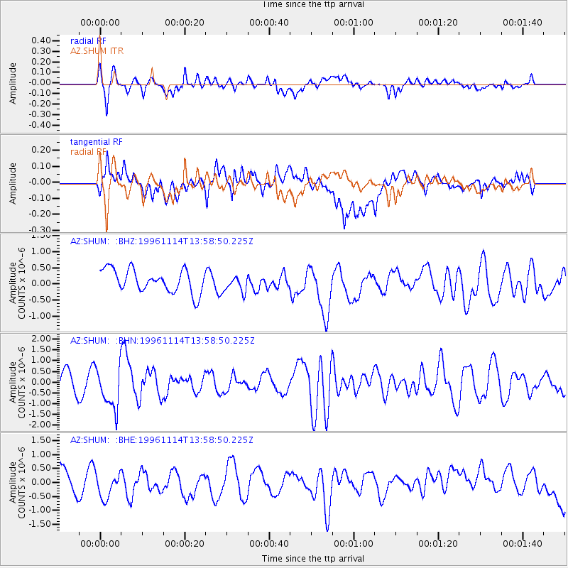
SHUM AZ.SHUM - Earthquake Result Viewer
*The percent match for this event was below the threshold and hence no stack was calculated.
| Earthquake location: |
Fiji Islands Region |
| Earthquake latitude/longitude: |
-21.2/-176.6 |
| Earthquake time(UTC): |
1996/11/14 (319) 13:47:38 GMT |
| Earthquake Depth: |
192 km |
| Earthquake Magnitude: |
5.9 MB, 6.2 UNKNOWN, 6.1 MW |
| Earthquake Catalog/Contributor: |
WHDF/NEIC |
|
| Network: |
AZ ANZA Regional Network |
| Station: |
SHUM AZ.SHUM |
| Lat/Lon: |
33.63 N/116.44 W |
| Elevation: |
1195 m |
|
| Distance: |
79.1 deg |
| Az: |
47.48 deg |
| Baz: |
235.501 deg |
| Ray Param: |
$rayparam |
*The percent match for this event was below the threshold and hence was not used in the summary stack. |
|
| Radial Match: |
58.70248 % |
| Radial Bump: |
400 |
| Transverse Match: |
51.021343 % |
| Transverse Bump: |
400 |
| SOD ConfigId: |
4480 |
| Insert Time: |
2010-02-26 20:41:42.945 +0000 |
| GWidth: |
2.5 |
| Max Bumps: |
400 |
| Tol: |
0.001 |
|
Signal To Noise
| Channel | StoN | STA | LTA |
| AZ:SHUM: :BHN:19961114T13:58:50.225Z | 2.1869552 | 9.704132E-7 | 4.4372797E-7 |
| AZ:SHUM: :BHE:19961114T13:58:50.225Z | 1.1328241 | 4.2890125E-7 | 3.786124E-7 |
| AZ:SHUM: :BHZ:19961114T13:58:50.225Z | 0.74162436 | 2.6134884E-7 | 3.524006E-7 |
| Arrivals |
| Ps | |
| PpPs | |
| PsPs/PpSs | |


