You are here: Home > Network List > AZ - ANZA Regional Network Stations List
> Station SHUM AZ.SHUM > Earthquake Result Viewer
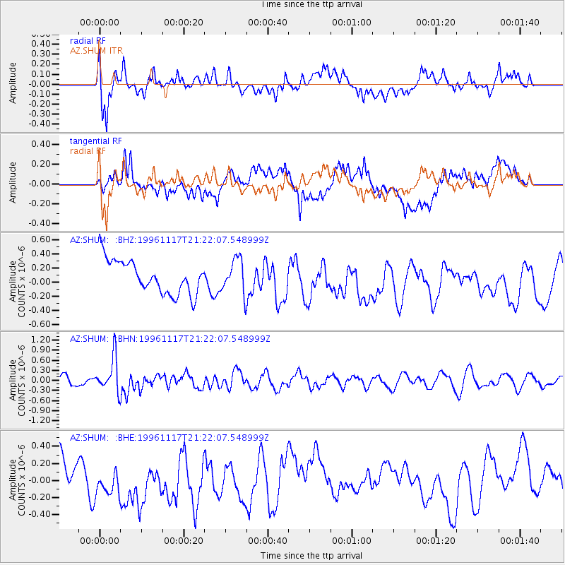
SHUM AZ.SHUM - Earthquake Result Viewer
*The percent match for this event was below the threshold and hence no stack was calculated.
| Earthquake location: |
South Of Fiji Islands |
| Earthquake latitude/longitude: |
-22.2/-179.7 |
| Earthquake time(UTC): |
1996/11/17 (322) 21:11:20 GMT |
| Earthquake Depth: |
592 km |
| Earthquake Magnitude: |
5.5 MB, 6.1 UNKNOWN, 6.0 MW |
| Earthquake Catalog/Contributor: |
WHDF/NEIC |
|
| Network: |
AZ ANZA Regional Network |
| Station: |
SHUM AZ.SHUM |
| Lat/Lon: |
33.63 N/116.44 W |
| Elevation: |
1195 m |
|
| Distance: |
81.9 deg |
| Az: |
48.815 deg |
| Baz: |
236.72 deg |
| Ray Param: |
$rayparam |
*The percent match for this event was below the threshold and hence was not used in the summary stack. |
|
| Radial Match: |
63.091694 % |
| Radial Bump: |
400 |
| Transverse Match: |
47.110294 % |
| Transverse Bump: |
400 |
| SOD ConfigId: |
4480 |
| Insert Time: |
2010-02-26 20:41:49.687 +0000 |
| GWidth: |
2.5 |
| Max Bumps: |
400 |
| Tol: |
0.001 |
|
Signal To Noise
| Channel | StoN | STA | LTA |
| AZ:SHUM: :BHN:19961117T21:22:07.548999Z | 3.3616118 | 5.3447064E-7 | 1.5899238E-7 |
| AZ:SHUM: :BHE:19961117T21:22:07.548999Z | 0.89491737 | 1.4711604E-7 | 1.6439064E-7 |
| AZ:SHUM: :BHZ:19961117T21:22:07.548999Z | 1.0723358 | 2.479092E-7 | 2.3118616E-7 |
| Arrivals |
| Ps | |
| PpPs | |
| PsPs/PpSs | |


