You are here: Home > Network List > AZ - ANZA Regional Network Stations List
> Station SHUM AZ.SHUM > Earthquake Result Viewer
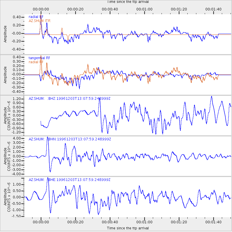
SHUM AZ.SHUM - Earthquake Result Viewer
*The percent match for this event was below the threshold and hence no stack was calculated.
| Earthquake location: |
Tonga Islands Region |
| Earthquake latitude/longitude: |
-18.4/-172.3 |
| Earthquake time(UTC): |
1996/12/03 (338) 12:56:56 GMT |
| Earthquake Depth: |
33 km |
| Earthquake Magnitude: |
6.0 MB, 6.0 MS, 6.1 UNKNOWN, 6.1 MW |
| Earthquake Catalog/Contributor: |
WHDF/NEIC |
|
| Network: |
AZ ANZA Regional Network |
| Station: |
SHUM AZ.SHUM |
| Lat/Lon: |
33.63 N/116.44 W |
| Elevation: |
1195 m |
|
| Distance: |
74.2 deg |
| Az: |
45.845 deg |
| Baz: |
234.76 deg |
| Ray Param: |
$rayparam |
*The percent match for this event was below the threshold and hence was not used in the summary stack. |
|
| Radial Match: |
71.64693 % |
| Radial Bump: |
400 |
| Transverse Match: |
51.46521 % |
| Transverse Bump: |
400 |
| SOD ConfigId: |
4480 |
| Insert Time: |
2010-02-26 20:41:55.826 +0000 |
| GWidth: |
2.5 |
| Max Bumps: |
400 |
| Tol: |
0.001 |
|
Signal To Noise
| Channel | StoN | STA | LTA |
| AZ:SHUM: :BHN:19961203T13:07:59.248999Z | 6.9629717 | 1.7312167E-6 | 2.4863186E-7 |
| AZ:SHUM: :BHE:19961203T13:07:59.248999Z | 2.6518803 | 8.3018875E-7 | 3.130567E-7 |
| AZ:SHUM: :BHZ:19961203T13:07:59.248999Z | 1.5256217 | 5.601891E-7 | 3.6718745E-7 |
| Arrivals |
| Ps | |
| PpPs | |
| PsPs/PpSs | |


