You are here: Home > Network List > AZ - ANZA Regional Network Stations List
> Station SHUM AZ.SHUM > Earthquake Result Viewer
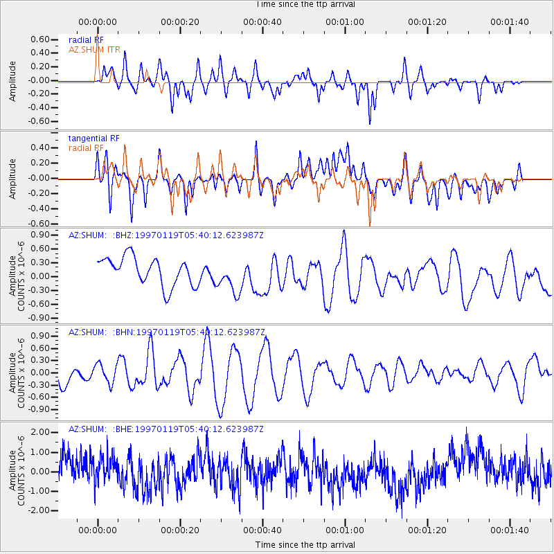
SHUM AZ.SHUM - Earthquake Result Viewer
*The percent match for this event was below the threshold and hence no stack was calculated.
| Earthquake location: |
Andreanof Islands, Aleutian Is. |
| Earthquake latitude/longitude: |
51.5/-178.2 |
| Earthquake time(UTC): |
1997/01/19 (019) 05:32:12 GMT |
| Earthquake Depth: |
33 km |
| Earthquake Magnitude: |
5.7 ML, 5.1 MS, 5.2 MB |
| Earthquake Catalog/Contributor: |
WHDF/NEIC |
|
| Network: |
AZ ANZA Regional Network |
| Station: |
SHUM AZ.SHUM |
| Lat/Lon: |
33.63 N/116.44 W |
| Elevation: |
1195 m |
|
| Distance: |
47.4 deg |
| Az: |
87.155 deg |
| Baz: |
311.572 deg |
| Ray Param: |
$rayparam |
*The percent match for this event was below the threshold and hence was not used in the summary stack. |
|
| Radial Match: |
40.84087 % |
| Radial Bump: |
400 |
| Transverse Match: |
43.5433 % |
| Transverse Bump: |
400 |
| SOD ConfigId: |
4480 |
| Insert Time: |
2010-02-26 20:42:02.861 +0000 |
| GWidth: |
2.5 |
| Max Bumps: |
400 |
| Tol: |
0.001 |
|
Signal To Noise
| Channel | StoN | STA | LTA |
| AZ:SHUM: :BHN:19970119T05:40:12.623987Z | 1.0079346 | 2.3977387E-7 | 2.3788635E-7 |
| AZ:SHUM: :BHE:19970119T05:40:12.623987Z | 0.9944855 | 6.8624433E-7 | 6.9004966E-7 |
| AZ:SHUM: :BHZ:19970119T05:40:12.623987Z | 1.2421144 | 3.7640137E-7 | 3.0303278E-7 |
| Arrivals |
| Ps | |
| PpPs | |
| PsPs/PpSs | |


