You are here: Home > Network List > AZ - ANZA Regional Network Stations List
> Station SHUM AZ.SHUM > Earthquake Result Viewer
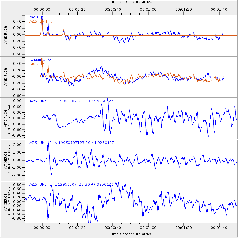
SHUM AZ.SHUM - Earthquake Result Viewer
*The percent match for this event was below the threshold and hence no stack was calculated.
| Earthquake location: |
Kuril Islands |
| Earthquake latitude/longitude: |
43.7/147.6 |
| Earthquake time(UTC): |
1996/05/07 (128) 23:20:00 GMT |
| Earthquake Depth: |
54 km |
| Earthquake Magnitude: |
6.2 MB, 5.6 MS, 6.2 UNKNOWN, 5.2 MS |
| Earthquake Catalog/Contributor: |
WHDF/NEIC |
|
| Network: |
AZ ANZA Regional Network |
| Station: |
SHUM AZ.SHUM |
| Lat/Lon: |
33.63 N/116.44 W |
| Elevation: |
1195 m |
|
| Distance: |
71.5 deg |
| Az: |
61.035 deg |
| Baz: |
310.494 deg |
| Ray Param: |
$rayparam |
*The percent match for this event was below the threshold and hence was not used in the summary stack. |
|
| Radial Match: |
59.49247 % |
| Radial Bump: |
400 |
| Transverse Match: |
55.18926 % |
| Transverse Bump: |
400 |
| SOD ConfigId: |
4480 |
| Insert Time: |
2010-02-26 20:42:06.211 +0000 |
| GWidth: |
2.5 |
| Max Bumps: |
400 |
| Tol: |
0.001 |
|
Signal To Noise
| Channel | StoN | STA | LTA |
| AZ:SHUM: :BHN:19960507T23:30:44.925012Z | 11.75558 | 9.669501E-7 | 8.2254566E-8 |
| AZ:SHUM: :BHE:19960507T23:30:44.925012Z | 1.0838147 | 3.3475374E-7 | 3.0886622E-7 |
| AZ:SHUM: :BHZ:19960507T23:30:44.925012Z | 2.0787427 | 4.1573878E-7 | 1.999953E-7 |
| Arrivals |
| Ps | |
| PpPs | |
| PsPs/PpSs | |


