You are here: Home > Network List > AZ - ANZA Regional Network Stations List
> Station SHUM AZ.SHUM > Earthquake Result Viewer
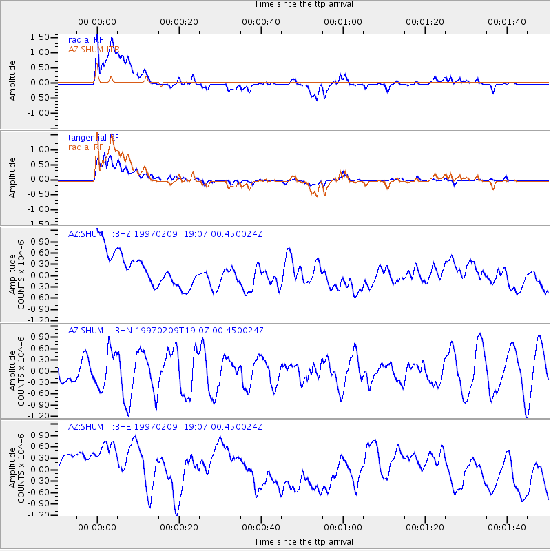
SHUM AZ.SHUM - Earthquake Result Viewer
*The percent match for this event was below the threshold and hence no stack was calculated.
| Earthquake location: |
Near East Coast Of Kamchatka |
| Earthquake latitude/longitude: |
55.2/161.9 |
| Earthquake time(UTC): |
1997/02/09 (040) 18:57:37 GMT |
| Earthquake Depth: |
33 km |
| Earthquake Magnitude: |
5.9 MB, 5.3 MS, 5.8 UNKNOWN, 5.7 MW |
| Earthquake Catalog/Contributor: |
WHDF/NEIC |
|
| Network: |
AZ ANZA Regional Network |
| Station: |
SHUM AZ.SHUM |
| Lat/Lon: |
33.63 N/116.44 W |
| Elevation: |
1195 m |
|
| Distance: |
58.6 deg |
| Az: |
75.332 deg |
| Baz: |
318.381 deg |
| Ray Param: |
$rayparam |
*The percent match for this event was below the threshold and hence was not used in the summary stack. |
|
| Radial Match: |
36.36654 % |
| Radial Bump: |
400 |
| Transverse Match: |
56.975647 % |
| Transverse Bump: |
400 |
| SOD ConfigId: |
4480 |
| Insert Time: |
2010-02-26 20:42:08.651 +0000 |
| GWidth: |
2.5 |
| Max Bumps: |
400 |
| Tol: |
0.001 |
|
Signal To Noise
| Channel | StoN | STA | LTA |
| AZ:SHUM: :BHN:19970209T19:07:00.450024Z | 1.5437229 | 4.829213E-7 | 3.1282897E-7 |
| AZ:SHUM: :BHE:19970209T19:07:00.450024Z | 1.1289779 | 1.5207901E-6 | 1.3470503E-6 |
| AZ:SHUM: :BHZ:19970209T19:07:00.450024Z | 0.6135685 | 2.7287618E-7 | 4.4473632E-7 |
| Arrivals |
| Ps | |
| PpPs | |
| PsPs/PpSs | |


