KOM Kota Tinggi - Earthquake Result Viewer
Earthquake location: Kyushu, Japan
Earthquake latitude/longitude: 30.0/131.8
Earthquake time(UTC): 2011/04/09 (099) 12:57:48 GMT
Earthquake Depth: 17 km
Earthquake Magnitude: 6.1 MB, 5.6 MS, 6.0 MW, 6.0 MW
Earthquake Catalog/Contributor: WHDF/NEIC
Network: MY Malaysian National Seismic Network
Station: KOM Kota Tinggi
Lat/Lon: 1.79 N/103.85 E
Elevation: 49 m
Distance: 38.6 deg
Az: 228.631 deg
Baz: 40.641 deg
Ray Param: 0.07544635
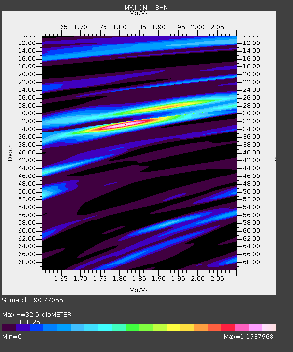
Estimated Moho Depth: 32.5 km
Estimated Crust Vp/Vs: 1.81
Assumed Crust Vp: 6.24 km/s
Estimated Crust Vs: 3.443 km/s
Estimated Crust Poisson's Ratio: 0.28
Radial Match: 90.77055 %
Radial Bump: 400
Transverse Match: 62.873695 %
Transverse Bump: 400
SOD ConfigId: 356183
Insert Time: 2011-09-27 02:59:25.854 +0000
GWidth: 2.5
Max Bumps: 400
Tol: 0.001

Signal To Noise

ChannelStoNSTALTA
MY:KOM: :BHZ:20110409T13:04:40.119999Z9.4330088.8824913E-79.416394E-8
MY:KOM: :BHN:20110409T13:04:40.119999Z4.57776643.7606492E-78.215031E-8
MY:KOM: :BHE:20110409T13:04:40.119999Z4.18633943.4925074E-78.342628E-8
Arrivals
Ps4.5 SECOND
PpPs14 SECOND
PsPs/PpSs18 SECOND