You are here: Home > Network List > AZ - ANZA Regional Network Stations List
> Station SHUM AZ.SHUM > Earthquake Result Viewer
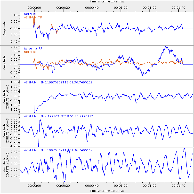
SHUM AZ.SHUM - Earthquake Result Viewer
*The percent match for this event was below the threshold and hence no stack was calculated.
| Earthquake location: |
Tonga Islands |
| Earthquake latitude/longitude: |
-16.6/-173.9 |
| Earthquake time(UTC): |
1997/03/19 (078) 17:50:42 GMT |
| Earthquake Depth: |
99 km |
| Earthquake Magnitude: |
5.5 MB, 5.7 UNKNOWN, 5.7 MW |
| Earthquake Catalog/Contributor: |
WHDF/NEIC |
|
| Network: |
AZ ANZA Regional Network |
| Station: |
SHUM AZ.SHUM |
| Lat/Lon: |
33.63 N/116.44 W |
| Elevation: |
1195 m |
|
| Distance: |
74.1 deg |
| Az: |
46.989 deg |
| Baz: |
237.174 deg |
| Ray Param: |
$rayparam |
*The percent match for this event was below the threshold and hence was not used in the summary stack. |
|
| Radial Match: |
67.12453 % |
| Radial Bump: |
400 |
| Transverse Match: |
31.168861 % |
| Transverse Bump: |
400 |
| SOD ConfigId: |
4480 |
| Insert Time: |
2010-02-26 20:42:12.598 +0000 |
| GWidth: |
2.5 |
| Max Bumps: |
400 |
| Tol: |
0.001 |
|
Signal To Noise
| Channel | StoN | STA | LTA |
| AZ:SHUM: :BHN:19970319T18:01:36.749011Z | 3.3385243 | 5.489037E-7 | 1.6441507E-7 |
| AZ:SHUM: :BHE:19970319T18:01:36.749011Z | 0.68942034 | 5.3105236E-7 | 7.7028824E-7 |
| AZ:SHUM: :BHZ:19970319T18:01:36.749011Z | 0.8763735 | 5.177557E-7 | 5.907934E-7 |
| Arrivals |
| Ps | |
| PpPs | |
| PsPs/PpSs | |


