You are here: Home > Network List > TA - USArray Transportable Network (new EarthScope stations) Stations List
> Station T25A Trinidad, CO, USA > Earthquake Result Viewer
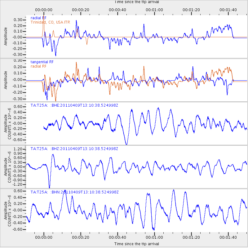
T25A Trinidad, CO, USA - Earthquake Result Viewer
*The percent match for this event was below the threshold and hence no stack was calculated.
| Earthquake location: |
Kyushu, Japan |
| Earthquake latitude/longitude: |
30.0/131.8 |
| Earthquake time(UTC): |
2011/04/09 (099) 12:57:48 GMT |
| Earthquake Depth: |
17 km |
| Earthquake Magnitude: |
6.1 MB, 5.6 MS, 6.0 MW, 6.0 MW |
| Earthquake Catalog/Contributor: |
WHDF/NEIC |
|
| Network: |
TA USArray Transportable Network (new EarthScope stations) |
| Station: |
T25A Trinidad, CO, USA |
| Lat/Lon: |
37.14 N/104.41 W |
| Elevation: |
2017 m |
|
| Distance: |
95.0 deg |
| Az: |
41.799 deg |
| Baz: |
313.655 deg |
| Ray Param: |
$rayparam |
*The percent match for this event was below the threshold and hence was not used in the summary stack. |
|
| Radial Match: |
49.034267 % |
| Radial Bump: |
400 |
| Transverse Match: |
61.861637 % |
| Transverse Bump: |
352 |
| SOD ConfigId: |
356183 |
| Insert Time: |
2011-09-27 03:04:38.125 +0000 |
| GWidth: |
2.5 |
| Max Bumps: |
400 |
| Tol: |
0.001 |
|
Signal To Noise
| Channel | StoN | STA | LTA |
| TA:T25A: :BHZ:20110409T13:10:38.524998Z | 2.4846668 | 5.7754374E-7 | 2.3244314E-7 |
| TA:T25A: :BHN:20110409T13:10:38.524998Z | 0.73647916 | 1.3754938E-7 | 1.8676614E-7 |
| TA:T25A: :BHE:20110409T13:10:38.524998Z | 1.0651166 | 1.4533855E-7 | 1.3645317E-7 |
| Arrivals |
| Ps | |
| PpPs | |
| PsPs/PpSs | |


