You are here: Home > Network List > AZ - ANZA Regional Network Stations List
> Station SHUM AZ.SHUM > Earthquake Result Viewer
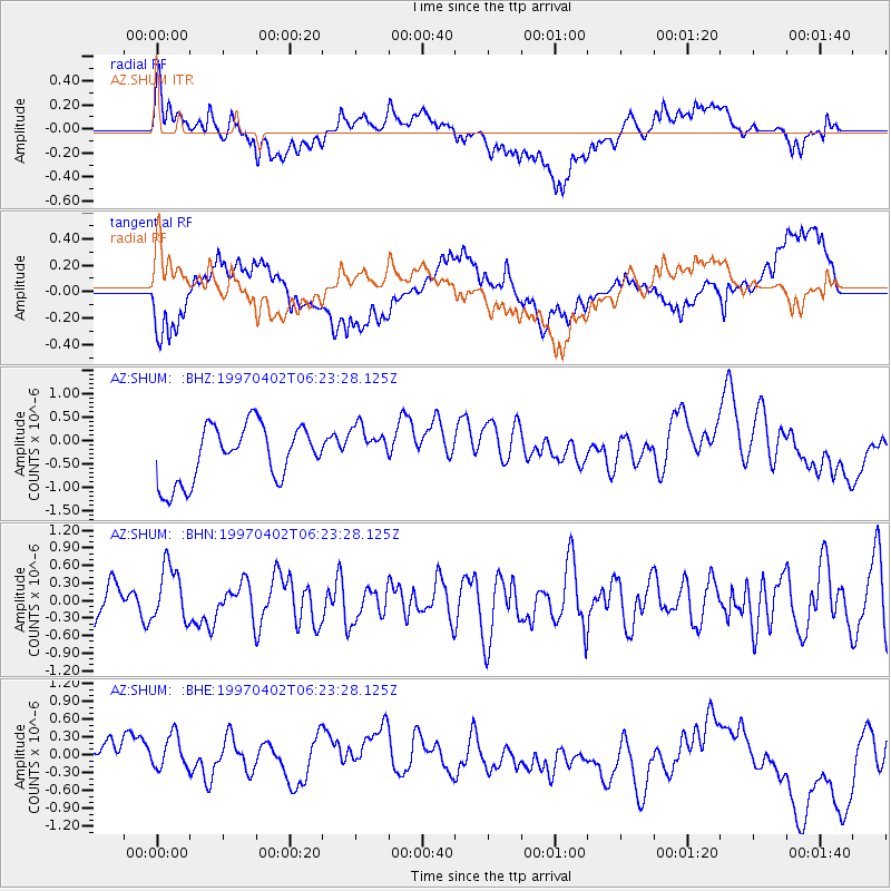
SHUM AZ.SHUM - Earthquake Result Viewer
*The percent match for this event was below the threshold and hence no stack was calculated.
| Earthquake location: |
Windward Islands |
| Earthquake latitude/longitude: |
11.4/-60.9 |
| Earthquake time(UTC): |
1997/04/02 (092) 06:14:31 GMT |
| Earthquake Depth: |
45 km |
| Earthquake Magnitude: |
5.8 MB, 5.5 MS, 6.2 UNKNOWN, 5.6 MD |
| Earthquake Catalog/Contributor: |
WHDF/NEIC |
|
| Network: |
AZ ANZA Regional Network |
| Station: |
SHUM AZ.SHUM |
| Lat/Lon: |
33.63 N/116.44 W |
| Elevation: |
1195 m |
|
| Distance: |
55.1 deg |
| Az: |
303.065 deg |
| Baz: |
99.975 deg |
| Ray Param: |
$rayparam |
*The percent match for this event was below the threshold and hence was not used in the summary stack. |
|
| Radial Match: |
53.601097 % |
| Radial Bump: |
400 |
| Transverse Match: |
51.010967 % |
| Transverse Bump: |
400 |
| SOD ConfigId: |
4480 |
| Insert Time: |
2010-02-26 20:42:18.517 +0000 |
| GWidth: |
2.5 |
| Max Bumps: |
400 |
| Tol: |
0.001 |
|
Signal To Noise
| Channel | StoN | STA | LTA |
| AZ:SHUM: :BHN:19970402T06:23:28.125Z | 0.9939884 | 4.7034854E-7 | 4.7319318E-7 |
| AZ:SHUM: :BHE:19970402T06:23:28.125Z | 0.6490915 | 2.8493054E-7 | 4.3896827E-7 |
| AZ:SHUM: :BHZ:19970402T06:23:28.125Z | 0.7815524 | 4.6555243E-7 | 5.9567657E-7 |
| Arrivals |
| Ps | |
| PpPs | |
| PsPs/PpSs | |


