You are here: Home > Network List > TA - USArray Transportable Network (new EarthScope stations) Stations List
> Station J34A George, IA, USA > Earthquake Result Viewer
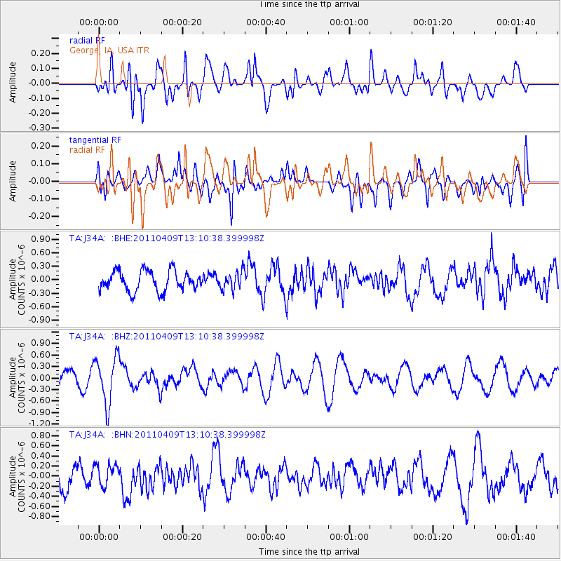
J34A George, IA, USA - Earthquake Result Viewer
*The percent match for this event was below the threshold and hence no stack was calculated.
| Earthquake location: |
Kyushu, Japan |
| Earthquake latitude/longitude: |
30.0/131.8 |
| Earthquake time(UTC): |
2011/04/09 (099) 12:57:48 GMT |
| Earthquake Depth: |
17 km |
| Earthquake Magnitude: |
6.1 MB, 5.6 MS, 6.0 MW, 6.0 MW |
| Earthquake Catalog/Contributor: |
WHDF/NEIC |
|
| Network: |
TA USArray Transportable Network (new EarthScope stations) |
| Station: |
J34A George, IA, USA |
| Lat/Lon: |
43.28 N/95.96 W |
| Elevation: |
432 m |
|
| Distance: |
94.9 deg |
| Az: |
32.853 deg |
| Baz: |
319.879 deg |
| Ray Param: |
$rayparam |
*The percent match for this event was below the threshold and hence was not used in the summary stack. |
|
| Radial Match: |
47.521954 % |
| Radial Bump: |
400 |
| Transverse Match: |
41.63262 % |
| Transverse Bump: |
400 |
| SOD ConfigId: |
356183 |
| Insert Time: |
2011-09-27 03:27:47.519 +0000 |
| GWidth: |
2.5 |
| Max Bumps: |
400 |
| Tol: |
0.001 |
|
Signal To Noise
| Channel | StoN | STA | LTA |
| TA:J34A: :BHZ:20110409T13:10:38.399998Z | 3.0198853 | 6.2121575E-7 | 2.0570839E-7 |
| TA:J34A: :BHN:20110409T13:10:38.399998Z | 0.75244844 | 2.0554313E-7 | 2.7316574E-7 |
| TA:J34A: :BHE:20110409T13:10:38.399998Z | 0.92928904 | 2.0459957E-7 | 2.2016785E-7 |
| Arrivals |
| Ps | |
| PpPs | |
| PsPs/PpSs | |


