You are here: Home > Network List > AZ - ANZA Regional Network Stations List
> Station SHUM AZ.SHUM > Earthquake Result Viewer
SHUM AZ.SHUM - Earthquake Result Viewer
*The percent match for this event was below the threshold and hence no stack was calculated.
| Earthquake location: |
Eastern Honshu, Japan |
| Earthquake latitude/longitude: |
37.1/140.9 |
| Earthquake time(UTC): |
1997/05/11 (131) 22:59:38 GMT |
| Earthquake Depth: |
49 km |
| Earthquake Magnitude: |
5.5 MB, 5.3 MS |
| Earthquake Catalog/Contributor: |
WHDF/NEIC |
|
| Network: |
AZ ANZA Regional Network |
| Station: |
SHUM AZ.SHUM |
| Lat/Lon: |
33.63 N/116.44 W |
| Elevation: |
1195 m |
|
| Distance: |
79.3 deg |
| Az: |
55.934 deg |
| Baz: |
307.444 deg |
| Ray Param: |
$rayparam |
*The percent match for this event was below the threshold and hence was not used in the summary stack. |
|
| Radial Match: |
50.04505 % |
| Radial Bump: |
400 |
| Transverse Match: |
47.884624 % |
| Transverse Bump: |
400 |
| SOD ConfigId: |
4480 |
| Insert Time: |
2010-02-26 20:42:29.492 +0000 |
| GWidth: |
2.5 |
| Max Bumps: |
400 |
| Tol: |
0.001 |
|
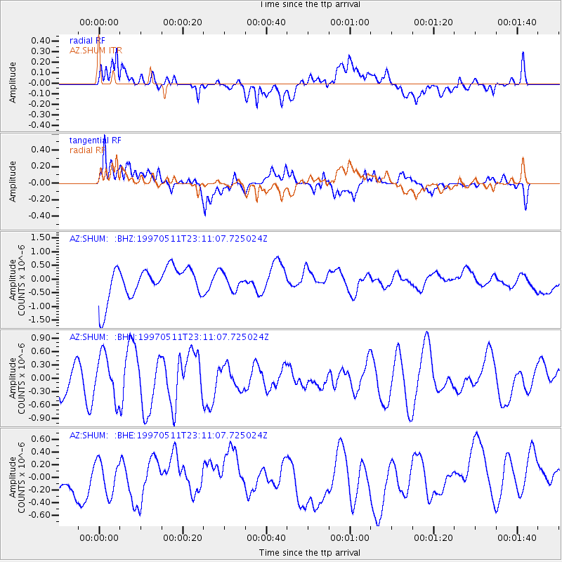
Signal To Noise
| Channel | StoN | STA | LTA |
| AZ:SHUM: :BHN:19970511T23:11:07.725024Z | 2.1684966 | 5.0121906E-7 | 2.3113668E-7 |
| AZ:SHUM: :BHE:19970511T23:11:07.725024Z | 0.63517463 | 2.634164E-7 | 4.1471495E-7 |
| AZ:SHUM: :BHZ:19970511T23:11:07.725024Z | 0.48855835 | 2.8672213E-7 | 5.8687385E-7 |
| Arrivals |
| Ps | |
| PpPs | |
| PsPs/PpSs | |


