You are here: Home > Network List > TA - USArray Transportable Network (new EarthScope stations) Stations List
> Station B33A Robert and Kassanda Mosher, Grygla, MN, USA > Earthquake Result Viewer
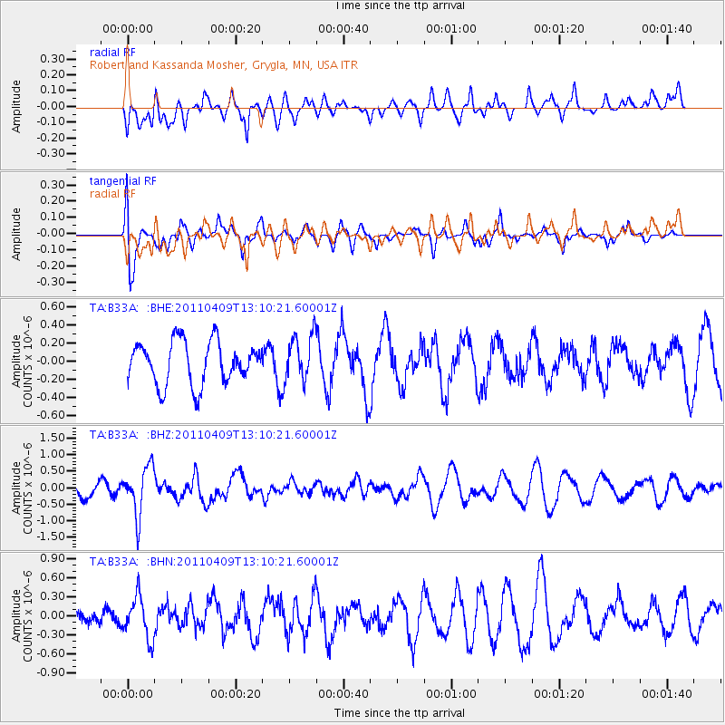
B33A Robert and Kassanda Mosher, Grygla, MN, USA - Earthquake Result Viewer
*The percent match for this event was below the threshold and hence no stack was calculated.
| Earthquake location: |
Kyushu, Japan |
| Earthquake latitude/longitude: |
30.0/131.8 |
| Earthquake time(UTC): |
2011/04/09 (099) 12:57:48 GMT |
| Earthquake Depth: |
17 km |
| Earthquake Magnitude: |
6.1 MB, 5.6 MS, 6.0 MW, 6.0 MW |
| Earthquake Catalog/Contributor: |
WHDF/NEIC |
|
| Network: |
TA USArray Transportable Network (new EarthScope stations) |
| Station: |
B33A Robert and Kassanda Mosher, Grygla, MN, USA |
| Lat/Lon: |
48.27 N/95.59 W |
| Elevation: |
362 m |
|
| Distance: |
91.3 deg |
| Az: |
29.45 deg |
| Baz: |
320.328 deg |
| Ray Param: |
$rayparam |
*The percent match for this event was below the threshold and hence was not used in the summary stack. |
|
| Radial Match: |
42.962566 % |
| Radial Bump: |
400 |
| Transverse Match: |
60.15375 % |
| Transverse Bump: |
400 |
| SOD ConfigId: |
356183 |
| Insert Time: |
2011-09-27 03:43:31.279 +0000 |
| GWidth: |
2.5 |
| Max Bumps: |
400 |
| Tol: |
0.001 |
|
Signal To Noise
| Channel | StoN | STA | LTA |
| TA:B33A: :BHZ:20110409T13:10:21.60001Z | 3.3525932 | 7.317243E-7 | 2.182562E-7 |
| TA:B33A: :BHN:20110409T13:10:21.60001Z | 1.824136 | 3.3355343E-7 | 1.8285556E-7 |
| TA:B33A: :BHE:20110409T13:10:21.60001Z | 1.0786861 | 2.5292064E-7 | 2.3447103E-7 |
| Arrivals |
| Ps | |
| PpPs | |
| PsPs/PpSs | |


