You are here: Home > Network List > AZ - ANZA Regional Network Stations List
> Station SHUM AZ.SHUM > Earthquake Result Viewer
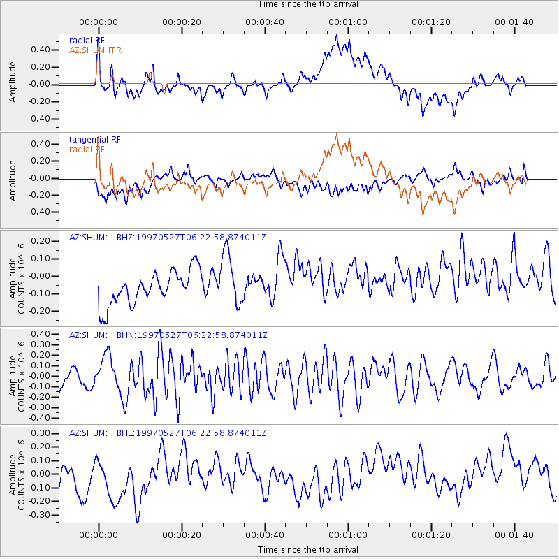
SHUM AZ.SHUM - Earthquake Result Viewer
*The percent match for this event was below the threshold and hence no stack was calculated.
| Earthquake location: |
Pacific-Antarctic Ridge |
| Earthquake latitude/longitude: |
-54.9/-136.2 |
| Earthquake time(UTC): |
1997/05/27 (147) 06:10:31 GMT |
| Earthquake Depth: |
10 km |
| Earthquake Magnitude: |
5.9 MS, 5.3 MB, 6.1 UNKNOWN, 6.0 MW |
| Earthquake Catalog/Contributor: |
WHDF/NEIC |
|
| Network: |
AZ ANZA Regional Network |
| Station: |
SHUM AZ.SHUM |
| Lat/Lon: |
33.63 N/116.44 W |
| Elevation: |
1195 m |
|
| Distance: |
89.8 deg |
| Az: |
16.355 deg |
| Baz: |
191.235 deg |
| Ray Param: |
$rayparam |
*The percent match for this event was below the threshold and hence was not used in the summary stack. |
|
| Radial Match: |
44.225685 % |
| Radial Bump: |
400 |
| Transverse Match: |
49.193054 % |
| Transverse Bump: |
400 |
| SOD ConfigId: |
4480 |
| Insert Time: |
2010-02-26 20:42:34.751 +0000 |
| GWidth: |
2.5 |
| Max Bumps: |
400 |
| Tol: |
0.001 |
|
Signal To Noise
| Channel | StoN | STA | LTA |
| AZ:SHUM: :BHN:19970527T06:22:58.874011Z | 1.9705975 | 1.5183223E-7 | 7.7048824E-8 |
| AZ:SHUM: :BHE:19970527T06:22:58.874011Z | 0.9518542 | 2.7955198E-7 | 2.93692E-7 |
| AZ:SHUM: :BHZ:19970527T06:22:58.874011Z | 1.636876 | 1.5525242E-7 | 9.484679E-8 |
| Arrivals |
| Ps | |
| PpPs | |
| PsPs/PpSs | |


