You are here: Home > Network List > US - United States National Seismic Network Stations List
> Station EGMT Eagleton, Montana, USA > Earthquake Result Viewer
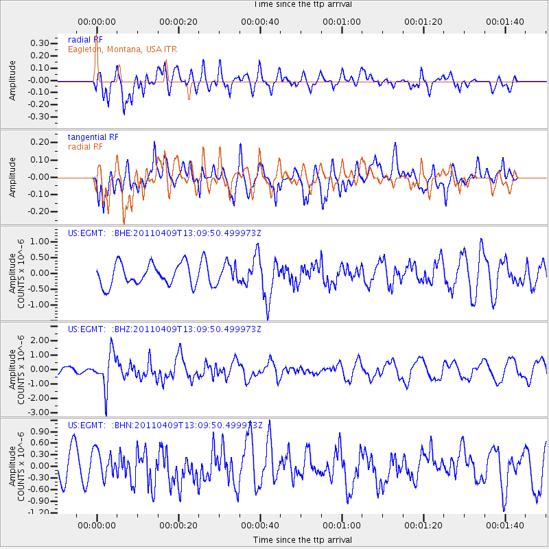
EGMT Eagleton, Montana, USA - Earthquake Result Viewer
*The percent match for this event was below the threshold and hence no stack was calculated.
| Earthquake location: |
Kyushu, Japan |
| Earthquake latitude/longitude: |
30.0/131.8 |
| Earthquake time(UTC): |
2011/04/09 (099) 12:57:48 GMT |
| Earthquake Depth: |
17 km |
| Earthquake Magnitude: |
6.1 MB, 5.6 MS, 6.0 MW, 6.0 MW |
| Earthquake Catalog/Contributor: |
WHDF/NEIC |
|
| Network: |
US United States National Seismic Network |
| Station: |
EGMT Eagleton, Montana, USA |
| Lat/Lon: |
48.02 N/109.75 W |
| Elevation: |
1055 m |
|
| Distance: |
84.8 deg |
| Az: |
36.344 deg |
| Baz: |
310.022 deg |
| Ray Param: |
$rayparam |
*The percent match for this event was below the threshold and hence was not used in the summary stack. |
|
| Radial Match: |
55.545593 % |
| Radial Bump: |
400 |
| Transverse Match: |
60.651566 % |
| Transverse Bump: |
400 |
| SOD ConfigId: |
356183 |
| Insert Time: |
2011-09-27 03:53:17.234 +0000 |
| GWidth: |
2.5 |
| Max Bumps: |
400 |
| Tol: |
0.001 |
|
Signal To Noise
| Channel | StoN | STA | LTA |
| US:EGMT: :BHZ:20110409T13:09:50.499973Z | 5.788235 | 1.242922E-6 | 2.1473248E-7 |
| US:EGMT: :BHN:20110409T13:09:50.499973Z | 1.0116831 | 3.565927E-7 | 3.5247467E-7 |
| US:EGMT: :BHE:20110409T13:09:50.499973Z | 0.9185805 | 3.1002043E-7 | 3.3749947E-7 |
| Arrivals |
| Ps | |
| PpPs | |
| PsPs/PpSs | |


