You are here: Home > Network List > AZ - ANZA Regional Network Stations List
> Station SHUM AZ.SHUM > Earthquake Result Viewer
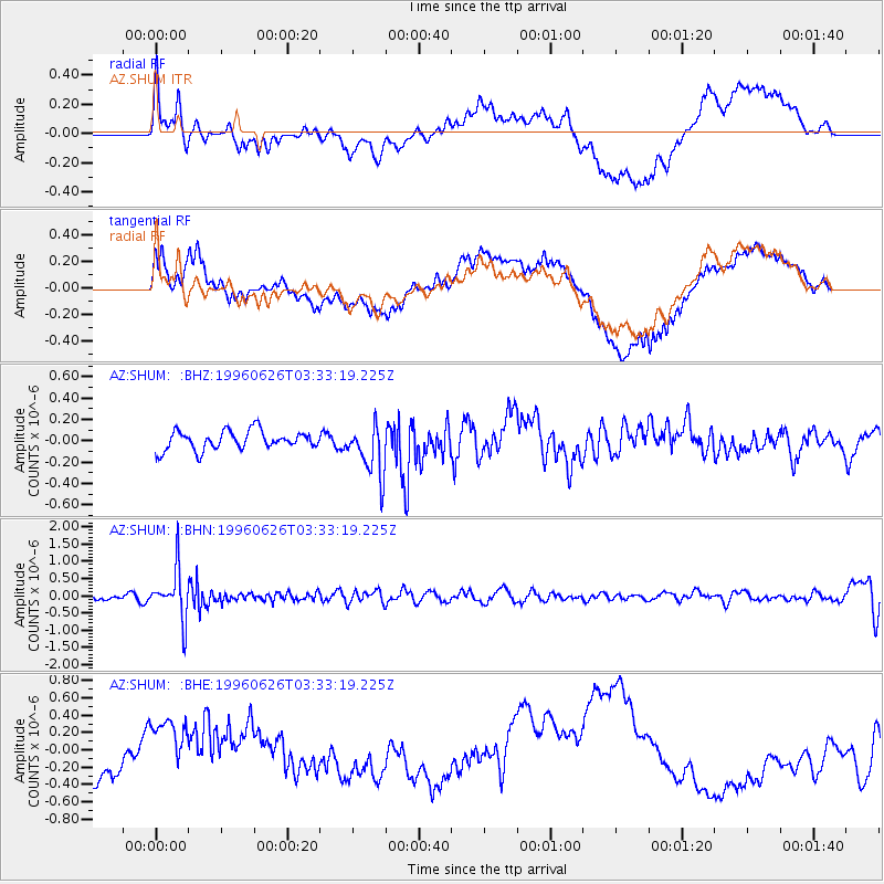
SHUM AZ.SHUM - Earthquake Result Viewer
*The percent match for this event was below the threshold and hence no stack was calculated.
| Earthquake location: |
Bonin Islands, Japan Region |
| Earthquake latitude/longitude: |
27.7/139.7 |
| Earthquake time(UTC): |
1996/06/26 (178) 03:22:03 GMT |
| Earthquake Depth: |
469 km |
| Earthquake Magnitude: |
5.5 MB, 6.3 UNKNOWN, 5.4 MB |
| Earthquake Catalog/Contributor: |
WHDF/NEIC |
|
| Network: |
AZ ANZA Regional Network |
| Station: |
SHUM AZ.SHUM |
| Lat/Lon: |
33.63 N/116.44 W |
| Elevation: |
1195 m |
|
| Distance: |
85.5 deg |
| Az: |
54.362 deg |
| Baz: |
300.287 deg |
| Ray Param: |
$rayparam |
*The percent match for this event was below the threshold and hence was not used in the summary stack. |
|
| Radial Match: |
61.634666 % |
| Radial Bump: |
400 |
| Transverse Match: |
55.572353 % |
| Transverse Bump: |
400 |
| SOD ConfigId: |
4480 |
| Insert Time: |
2010-02-26 20:42:37.247 +0000 |
| GWidth: |
2.5 |
| Max Bumps: |
400 |
| Tol: |
0.001 |
|
Signal To Noise
| Channel | StoN | STA | LTA |
| AZ:SHUM: :BHN:19960626T03:33:19.225Z | 7.644463 | 7.176829E-7 | 9.388271E-8 |
| AZ:SHUM: :BHE:19960626T03:33:19.225Z | 0.76344985 | 3.0009073E-7 | 3.9307199E-7 |
| AZ:SHUM: :BHZ:19960626T03:33:19.225Z | 2.7244022 | 2.4058855E-7 | 8.830876E-8 |
| Arrivals |
| Ps | |
| PpPs | |
| PsPs/PpSs | |


