You are here: Home > Network List > TA - USArray Transportable Network (new EarthScope stations) Stations List
> Station 121A Cookes Peak, Deming, NM, USA > Earthquake Result Viewer
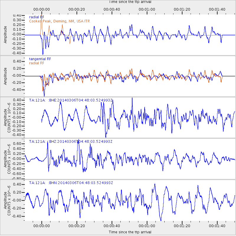
121A Cookes Peak, Deming, NM, USA - Earthquake Result Viewer
*The percent match for this event was below the threshold and hence no stack was calculated.
| Earthquake location: |
Near Coast Of Central Chile |
| Earthquake latitude/longitude: |
-33.3/-71.3 |
| Earthquake time(UTC): |
2014/03/06 (065) 04:37:05 GMT |
| Earthquake Depth: |
59 km |
| Earthquake Magnitude: |
5.4 MW |
| Earthquake Catalog/Contributor: |
ISC/ISC |
|
| Network: |
TA USArray Transportable Network (new EarthScope stations) |
| Station: |
121A Cookes Peak, Deming, NM, USA |
| Lat/Lon: |
32.53 N/107.79 W |
| Elevation: |
1652 m |
|
| Distance: |
74.0 deg |
| Az: |
328.483 deg |
| Baz: |
148.789 deg |
| Ray Param: |
$rayparam |
*The percent match for this event was below the threshold and hence was not used in the summary stack. |
|
| Radial Match: |
55.082905 % |
| Radial Bump: |
400 |
| Transverse Match: |
60.76379 % |
| Transverse Bump: |
400 |
| SOD ConfigId: |
3390531 |
| Insert Time: |
2019-04-10 13:03:12.140 +0000 |
| GWidth: |
2.5 |
| Max Bumps: |
400 |
| Tol: |
0.001 |
|
Signal To Noise
| Channel | StoN | STA | LTA |
| TA:121A: :BHZ:20140306T04:48:03.524993Z | 2.5833585 | 2.2955734E-7 | 8.886004E-8 |
| TA:121A: :BHN:20140306T04:48:03.524993Z | 1.8324938 | 1.8898258E-7 | 1.03128635E-7 |
| TA:121A: :BHE:20140306T04:48:03.524993Z | 0.87762636 | 1.3055976E-7 | 1.4876463E-7 |
| Arrivals |
| Ps | |
| PpPs | |
| PsPs/PpSs | |


