MUR Murrieta - Earthquake Result Viewer
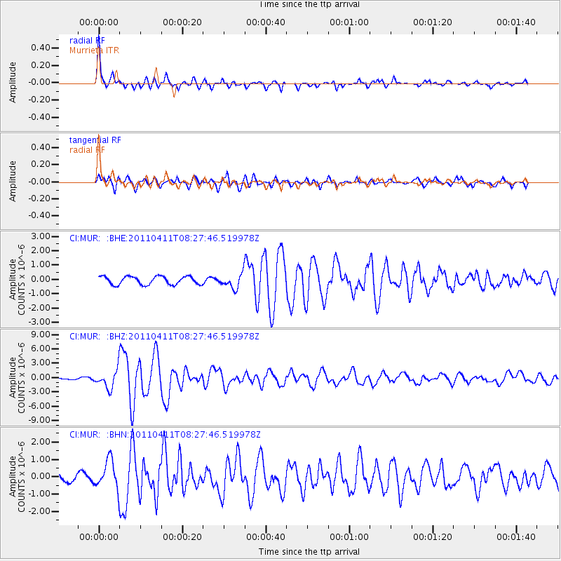
Earthquake location: Eastern Honshu, Japan
Earthquake latitude/longitude: 37.0/140.4
Earthquake time(UTC): 2011/04/11 (101) 08:16:12 GMT
Earthquake Depth: 11 km
Earthquake Magnitude: 6.4 MB, 6.5 MS, 6.6 MW, 6.6 MW
Earthquake Catalog/Contributor: WHDF/NEIC
Network: CI Caltech Regional Seismic Network
Station: MUR Murrieta
Lat/Lon: 33.60 N/117.20 W
Elevation: 562 m
Distance: 79.2 deg
Az: 56.069 deg
Baz: 307.265 deg
Ray Param: 0.049089063
Estimated Moho Depth: 27.25 km
Estimated Crust Vp/Vs: 1.68
Assumed Crust Vp: 6.264 km/s
Estimated Crust Vs: 3.723 km/s
Estimated Crust Poisson's Ratio: 0.23
Radial Match: 93.513824 %
Radial Bump: 354
Transverse Match: 76.72824 %
Transverse Bump: 400
SOD ConfigId: 356183
Insert Time: 2011-09-27 04:39:07.390 +0000
GWidth: 2.5
Max Bumps: 400
Tol: 0.001

Signal To Noise

ChannelStoNSTALTA
CI:MUR: :BHZ:20110411T08:27:46.519978Z9.6113622.0091923E-62.0904345E-7
CI:MUR: :BHN:20110411T08:27:46.519978Z4.16578.380107E-72.0116924E-7
CI:MUR: :BHE:20110411T08:27:46.519978Z1.83420485.2141553E-72.8427334E-7
Arrivals
Ps3.1 SECOND
PpPs11 SECOND
PsPs/PpSs14 SECOND