You are here: Home > Network List > CN - Canadian National Seismograph Network Stations List
> Station INK INUVIK, NT > Earthquake Result Viewer
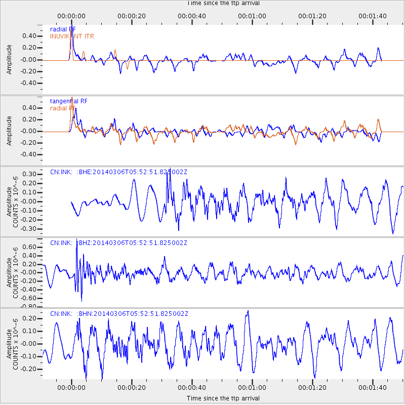
INK INUVIK, NT - Earthquake Result Viewer
*The percent match for this event was below the threshold and hence no stack was calculated.
| Earthquake location: |
Mariana Islands |
| Earthquake latitude/longitude: |
18.6/145.6 |
| Earthquake time(UTC): |
2014/03/06 (065) 05:42:36 GMT |
| Earthquake Depth: |
200 km |
| Earthquake Magnitude: |
5.5 MW |
| Earthquake Catalog/Contributor: |
ISC/ISC |
|
| Network: |
CN Canadian National Seismograph Network |
| Station: |
INK INUVIK, NT |
| Lat/Lon: |
68.31 N/133.53 W |
| Elevation: |
44 m |
|
| Distance: |
69.5 deg |
| Az: |
23.08 deg |
| Baz: |
268.707 deg |
| Ray Param: |
$rayparam |
*The percent match for this event was below the threshold and hence was not used in the summary stack. |
|
| Radial Match: |
66.25713 % |
| Radial Bump: |
400 |
| Transverse Match: |
59.875652 % |
| Transverse Bump: |
400 |
| SOD ConfigId: |
3390531 |
| Insert Time: |
2019-04-10 13:08:24.432 +0000 |
| GWidth: |
2.5 |
| Max Bumps: |
400 |
| Tol: |
0.001 |
|
Signal To Noise
| Channel | StoN | STA | LTA |
| CN:INK: :BHZ:20140306T05:52:51.825002Z | 2.2254329 | 2.6549415E-7 | 1.1930001E-7 |
| CN:INK: :BHN:20140306T05:52:51.825002Z | 1.1955047 | 1.1864998E-7 | 9.9246776E-8 |
| CN:INK: :BHE:20140306T05:52:51.825002Z | 1.8602778 | 1.5842463E-7 | 8.5161815E-8 |
| Arrivals |
| Ps | |
| PpPs | |
| PsPs/PpSs | |


