
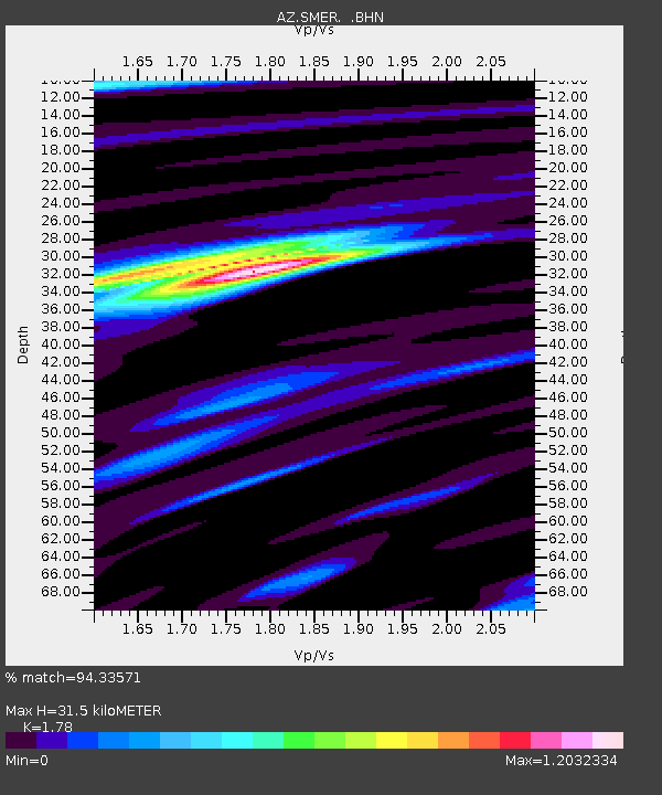
SMER AZ.SMER - Earthquake Result Viewer
| ||||||||||||||||||
| ||||||||||||||||||
| ||||||||||||||||||
|
Signal To Noise
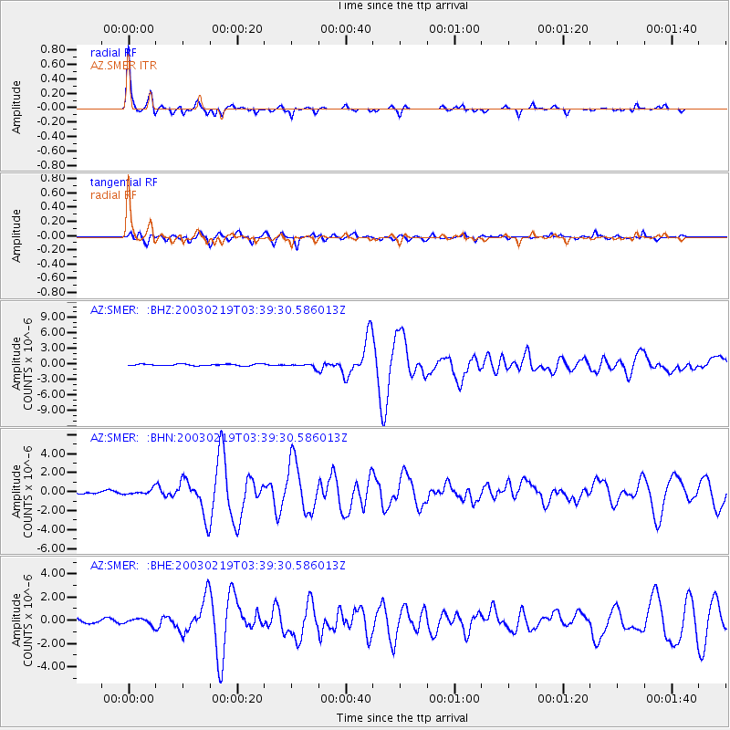
| Channel | StoN | STA | LTA |
| AZ:SMER: :BHN:20030219T03:39:30.586013Z | 2.3826637 | 2.5682132E-7 | 1.0778748E-7 |
| AZ:SMER: :BHE:20030219T03:39:30.586013Z | 1.7012284 | 2.7599424E-7 | 1.6223231E-7 |
| AZ:SMER: :BHZ:20030219T03:39:30.586013Z | 2.4954982 | 3.7346373E-7 | 1.49655E-7 |
| Arrivals | |
| Ps | 4.2 SECOND |
| PpPs | 13 SECOND |
| PsPs/PpSs | 17 SECOND |

