You are here: Home > Network List > TA - USArray Transportable Network (new EarthScope stations) Stations List
> Station MSTX Muleshoe, TX, USA > Earthquake Result Viewer
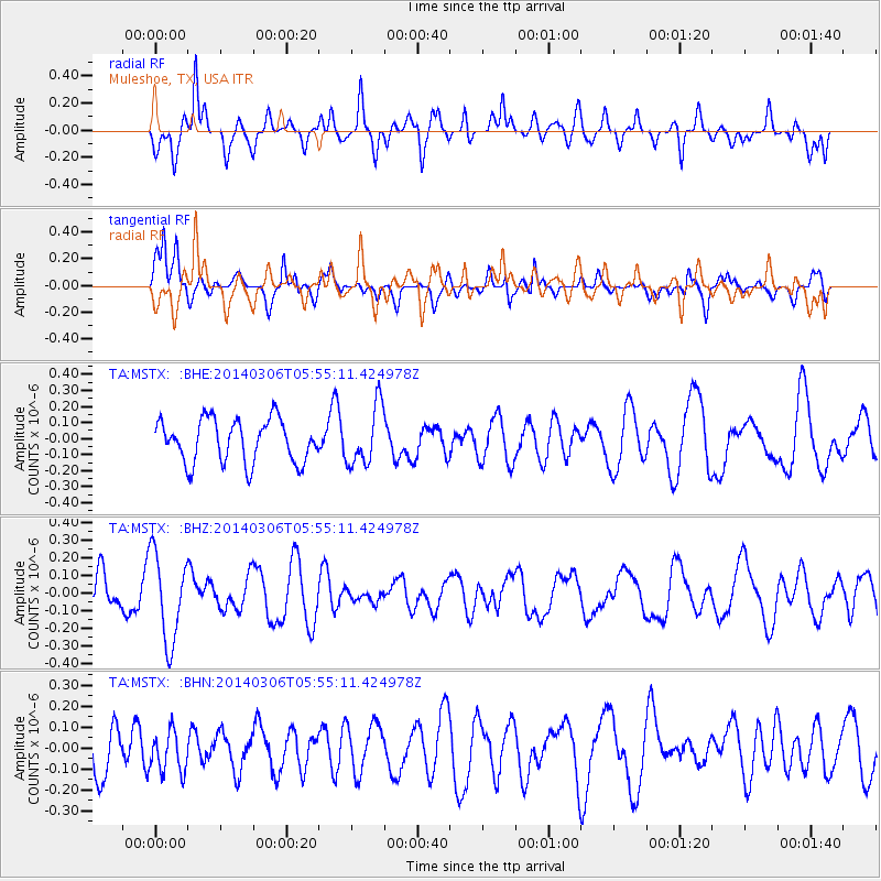
MSTX Muleshoe, TX, USA - Earthquake Result Viewer
*The percent match for this event was below the threshold and hence no stack was calculated.
| Earthquake location: |
Mariana Islands |
| Earthquake latitude/longitude: |
18.6/145.6 |
| Earthquake time(UTC): |
2014/03/06 (065) 05:42:36 GMT |
| Earthquake Depth: |
200 km |
| Earthquake Magnitude: |
5.5 MW |
| Earthquake Catalog/Contributor: |
ISC/ISC |
|
| Network: |
TA USArray Transportable Network (new EarthScope stations) |
| Station: |
MSTX Muleshoe, TX, USA |
| Lat/Lon: |
33.97 N/102.77 W |
| Elevation: |
1167 m |
|
| Distance: |
96.5 deg |
| Az: |
51.034 deg |
| Baz: |
297.494 deg |
| Ray Param: |
$rayparam |
*The percent match for this event was below the threshold and hence was not used in the summary stack. |
|
| Radial Match: |
66.05071 % |
| Radial Bump: |
355 |
| Transverse Match: |
56.21522 % |
| Transverse Bump: |
357 |
| SOD ConfigId: |
3390531 |
| Insert Time: |
2019-04-10 13:10:26.756 +0000 |
| GWidth: |
2.5 |
| Max Bumps: |
400 |
| Tol: |
0.001 |
|
Signal To Noise
| Channel | StoN | STA | LTA |
| TA:MSTX: :BHZ:20140306T05:55:11.424978Z | 2.6473122 | 2.495145E-7 | 9.425201E-8 |
| TA:MSTX: :BHN:20140306T05:55:11.424978Z | 0.7592517 | 9.682516E-8 | 1.2752709E-7 |
| TA:MSTX: :BHE:20140306T05:55:11.424978Z | 1.385948 | 1.8506191E-7 | 1.3352732E-7 |
| Arrivals |
| Ps | |
| PpPs | |
| PsPs/PpSs | |


