You are here: Home > Network List > US - United States National Seismic Network Stations List
> Station AMTX Amarillo, Texas, USA > Earthquake Result Viewer
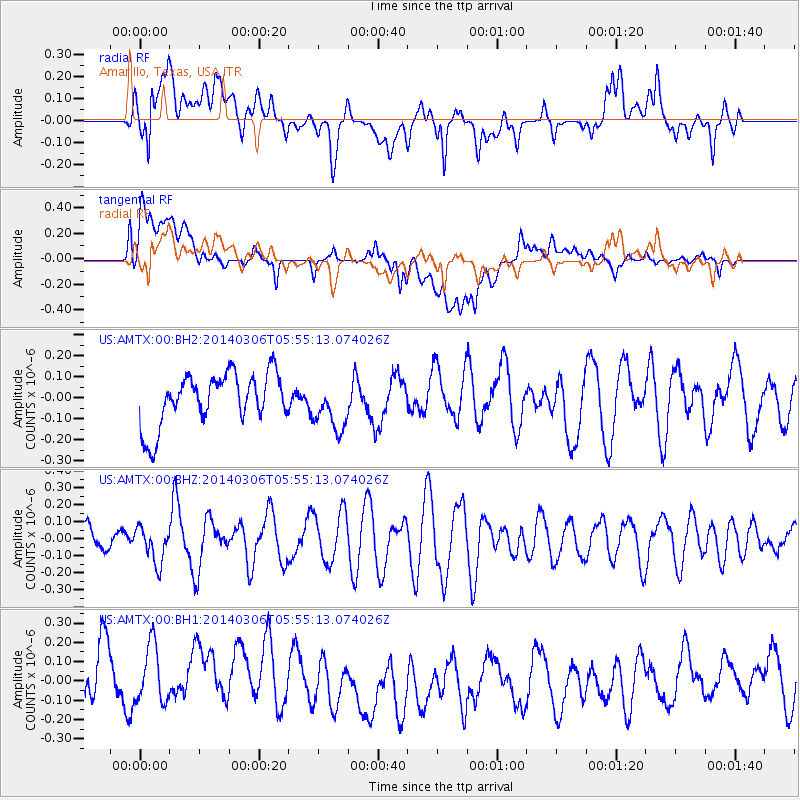
AMTX Amarillo, Texas, USA - Earthquake Result Viewer
*The percent match for this event was below the threshold and hence no stack was calculated.
| Earthquake location: |
Mariana Islands |
| Earthquake latitude/longitude: |
18.6/145.6 |
| Earthquake time(UTC): |
2014/03/06 (065) 05:42:36 GMT |
| Earthquake Depth: |
200 km |
| Earthquake Magnitude: |
5.5 MW |
| Earthquake Catalog/Contributor: |
ISC/ISC |
|
| Network: |
US United States National Seismic Network |
| Station: |
AMTX Amarillo, Texas, USA |
| Lat/Lon: |
34.53 N/101.41 W |
| Elevation: |
1010 m |
|
| Distance: |
97.3 deg |
| Az: |
50.003 deg |
| Baz: |
298.382 deg |
| Ray Param: |
$rayparam |
*The percent match for this event was below the threshold and hence was not used in the summary stack. |
|
| Radial Match: |
43.82196 % |
| Radial Bump: |
400 |
| Transverse Match: |
36.66411 % |
| Transverse Bump: |
400 |
| SOD ConfigId: |
3390531 |
| Insert Time: |
2019-04-10 13:10:47.375 +0000 |
| GWidth: |
2.5 |
| Max Bumps: |
400 |
| Tol: |
0.001 |
|
Signal To Noise
| Channel | StoN | STA | LTA |
| US:AMTX:00:BHZ:20140306T05:55:13.074026Z | 1.0841911 | 1.0059813E-7 | 9.278635E-8 |
| US:AMTX:00:BH1:20140306T05:55:13.074026Z | 0.9406332 | 1.8233861E-7 | 1.9384667E-7 |
| US:AMTX:00:BH2:20140306T05:55:13.074026Z | 1.1632466 | 1.2597393E-7 | 1.0829511E-7 |
| Arrivals |
| Ps | |
| PpPs | |
| PsPs/PpSs | |


