You are here: Home > Network List > TA - USArray Transportable Network (new EarthScope stations) Stations List
> Station E29A Napoleon, ND, USA > Earthquake Result Viewer
E29A Napoleon, ND, USA - Earthquake Result Viewer

| Earthquake location: |
Eastern Honshu, Japan |
| Earthquake latitude/longitude: |
37.0/140.4 |
| Earthquake time(UTC): |
2011/04/11 (101) 08:16:12 GMT |
| Earthquake Depth: |
11 km |
| Earthquake Magnitude: |
6.4 MB, 6.5 MS, 6.6 MW, 6.6 MW |
| Earthquake Catalog/Contributor: |
WHDF/NEIC |
|
| Network: |
TA USArray Transportable Network (new EarthScope stations) |
| Station: |
E29A Napoleon, ND, USA |
| Lat/Lon: |
46.57 N/99.64 W |
| Elevation: |
628 m |
|
| Distance: |
80.9 deg |
| Az: |
37.254 deg |
| Baz: |
315.378 deg |
| Ray Param: |
0.047954686 |
| Estimated Moho Depth: |
15.25 km |
| Estimated Crust Vp/Vs: |
1.61 |
| Assumed Crust Vp: |
6.53 km/s |
| Estimated Crust Vs: |
4.056 km/s |
| Estimated Crust Poisson's Ratio: |
0.19 |
|
| Radial Match: |
94.83519 % |
| Radial Bump: |
335 |
| Transverse Match: |
83.17795 % |
| Transverse Bump: |
344 |
| SOD ConfigId: |
356183 |
| Insert Time: |
2011-09-27 05:37:45.037 +0000 |
| GWidth: |
2.5 |
| Max Bumps: |
400 |
| Tol: |
0.001 |
|
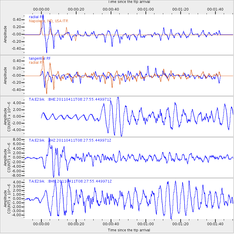
Signal To Noise
| Channel | StoN | STA | LTA |
| TA:E29A: :BHZ:20110411T08:27:55.449971Z | 20.436531 | 3.443041E-6 | 1.6847483E-7 |
| TA:E29A: :BHN:20110411T08:27:55.449971Z | 3.6353178 | 1.4132919E-6 | 3.8876706E-7 |
| TA:E29A: :BHE:20110411T08:27:55.449971Z | 1.6925147 | 8.651382E-7 | 5.111555E-7 |
| Arrivals |
| Ps | 1.5 SECOND |
| PpPs | 5.9 SECOND |
| PsPs/PpSs | 7.4 SECOND |


