You are here: Home > Network List > TA - USArray Transportable Network (new EarthScope stations) Stations List
> Station 333A Richland Springs, TX, USA > Earthquake Result Viewer
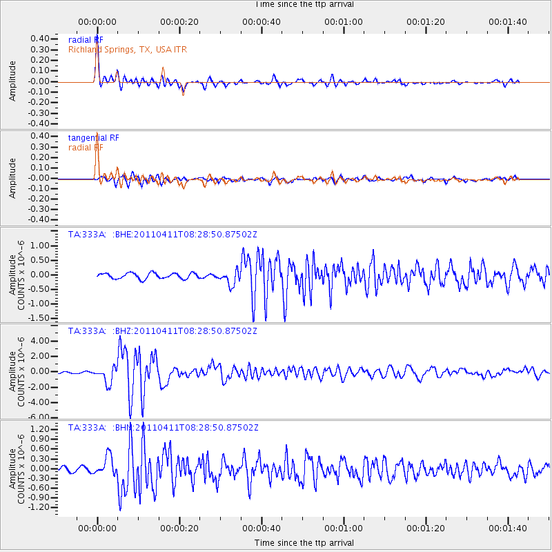
333A Richland Springs, TX, USA - Earthquake Result Viewer

| Earthquake location: |
Eastern Honshu, Japan |
| Earthquake latitude/longitude: |
37.0/140.4 |
| Earthquake time(UTC): |
2011/04/11 (101) 08:16:12 GMT |
| Earthquake Depth: |
11 km |
| Earthquake Magnitude: |
6.4 MB, 6.5 MS, 6.6 MW, 6.6 MW |
| Earthquake Catalog/Contributor: |
WHDF/NEIC |
|
| Network: |
TA USArray Transportable Network (new EarthScope stations) |
| Station: |
333A Richland Springs, TX, USA |
| Lat/Lon: |
31.32 N/98.98 W |
| Elevation: |
443 m |
|
| Distance: |
92.2 deg |
| Az: |
47.481 deg |
| Baz: |
316.41 deg |
| Ray Param: |
0.04148962 |
| Estimated Moho Depth: |
36.75 km |
| Estimated Crust Vp/Vs: |
1.88 |
| Assumed Crust Vp: |
6.498 km/s |
| Estimated Crust Vs: |
3.456 km/s |
| Estimated Crust Poisson's Ratio: |
0.30 |
|
| Radial Match: |
94.25859 % |
| Radial Bump: |
344 |
| Transverse Match: |
83.51905 % |
| Transverse Bump: |
400 |
| SOD ConfigId: |
356183 |
| Insert Time: |
2011-09-27 05:57:35.418 +0000 |
| GWidth: |
2.5 |
| Max Bumps: |
400 |
| Tol: |
0.001 |
|
Signal To Noise
| Channel | StoN | STA | LTA |
| TA:333A: :BHZ:20110411T08:28:50.87502Z | 11.441396 | 1.078273E-6 | 9.4243134E-8 |
| TA:333A: :BHN:20110411T08:28:50.87502Z | 5.1497674 | 3.0221193E-7 | 5.8684577E-8 |
| TA:333A: :BHE:20110411T08:28:50.87502Z | 2.5499516 | 2.4396198E-7 | 9.567318E-8 |
| Arrivals |
| Ps | 5.1 SECOND |
| PpPs | 16 SECOND |
| PsPs/PpSs | 21 SECOND |


