
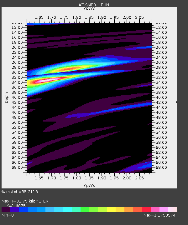
SMER AZ.SMER - Earthquake Result Viewer
| ||||||||||||||||||
| ||||||||||||||||||
| ||||||||||||||||||
|
Signal To Noise
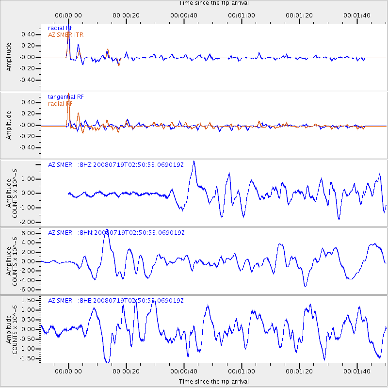
| Channel | StoN | STA | LTA |
| AZ:SMER: :BHN:20080719T02:50:53.069019Z | 3.8222916 | 5.59116E-7 | 1.462777E-7 |
| AZ:SMER: :BHE:20080719T02:50:53.069019Z | 0.9839098 | 1.7233978E-7 | 1.751581E-7 |
| AZ:SMER: :BHZ:20080719T02:50:53.069019Z | 1.1338927 | 1.1497373E-7 | 1.0139736E-7 |
| Arrivals | |
| Ps | 3.7 SECOND |
| PpPs | 14 SECOND |
| PsPs/PpSs | 17 SECOND |

