You are here: Home > Network List > TA - USArray Transportable Network (new EarthScope stations) Stations List
> Station G05D Wamic, OR, USA > Earthquake Result Viewer
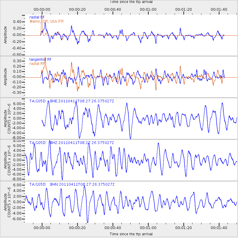
G05D Wamic, OR, USA - Earthquake Result Viewer
*The percent match for this event was below the threshold and hence no stack was calculated.
| Earthquake location: |
Eastern Honshu, Japan |
| Earthquake latitude/longitude: |
37.8/140.8 |
| Earthquake time(UTC): |
2011/04/11 (101) 08:16:50 GMT |
| Earthquake Depth: |
10 km |
| Earthquake Magnitude: |
5.8 MB |
| Earthquake Catalog/Contributor: |
WHDF/NEIC |
|
| Network: |
TA USArray Transportable Network (new EarthScope stations) |
| Station: |
G05D Wamic, OR, USA |
| Lat/Lon: |
45.24 N/121.32 W |
| Elevation: |
592 m |
|
| Distance: |
69.2 deg |
| Az: |
48.474 deg |
| Baz: |
302.91 deg |
| Ray Param: |
$rayparam |
*The percent match for this event was below the threshold and hence was not used in the summary stack. |
|
| Radial Match: |
76.72297 % |
| Radial Bump: |
332 |
| Transverse Match: |
56.57282 % |
| Transverse Bump: |
356 |
| SOD ConfigId: |
356183 |
| Insert Time: |
2011-09-27 08:06:32.893 +0000 |
| GWidth: |
2.5 |
| Max Bumps: |
400 |
| Tol: |
0.001 |
|
Signal To Noise
| Channel | StoN | STA | LTA |
| TA:G05D: :BHZ:20110411T08:27:26.375027Z | 0.7542628 | 3.696765E-6 | 4.901163E-6 |
| TA:G05D: :BHN:20110411T08:27:26.375027Z | 1.6111592 | 2.735415E-6 | 1.6977931E-6 |
| TA:G05D: :BHE:20110411T08:27:26.375027Z | 1.1776592 | 4.123947E-6 | 3.501817E-6 |
| Arrivals |
| Ps | |
| PpPs | |
| PsPs/PpSs | |


