You are here: Home > Network List > TA - USArray Transportable Network (new EarthScope stations) Stations List
> Station H36A Jessenland, Henderson, MN, USA > Earthquake Result Viewer
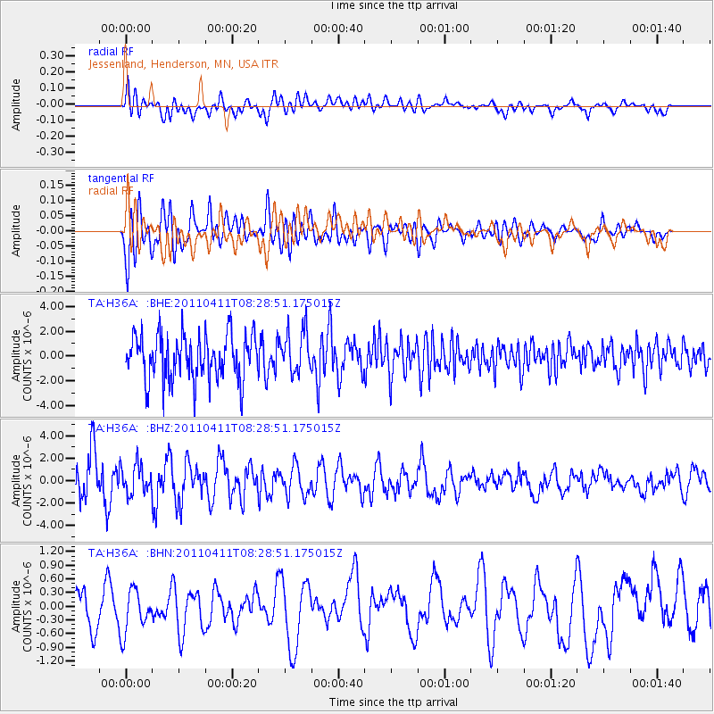
H36A Jessenland, Henderson, MN, USA - Earthquake Result Viewer
*The percent match for this event was below the threshold and hence no stack was calculated.
| Earthquake location: |
Eastern Honshu, Japan |
| Earthquake latitude/longitude: |
37.8/140.8 |
| Earthquake time(UTC): |
2011/04/11 (101) 08:16:50 GMT |
| Earthquake Depth: |
10 km |
| Earthquake Magnitude: |
5.8 MB |
| Earthquake Catalog/Contributor: |
WHDF/NEIC |
|
| Network: |
TA USArray Transportable Network (new EarthScope stations) |
| Station: |
H36A Jessenland, Henderson, MN, USA |
| Lat/Lon: |
44.58 N/93.93 W |
| Elevation: |
311 m |
|
| Distance: |
84.3 deg |
| Az: |
35.908 deg |
| Baz: |
319.447 deg |
| Ray Param: |
$rayparam |
*The percent match for this event was below the threshold and hence was not used in the summary stack. |
|
| Radial Match: |
70.34583 % |
| Radial Bump: |
400 |
| Transverse Match: |
79.6957 % |
| Transverse Bump: |
400 |
| SOD ConfigId: |
356183 |
| Insert Time: |
2011-09-27 08:15:10.387 +0000 |
| GWidth: |
2.5 |
| Max Bumps: |
400 |
| Tol: |
0.001 |
|
Signal To Noise
| Channel | StoN | STA | LTA |
| TA:H36A: :BHZ:20110411T08:28:51.175015Z | 0.27753556 | 1.2670521E-6 | 4.5653683E-6 |
| TA:H36A: :BHN:20110411T08:28:51.175015Z | 1.169981 | 4.8598184E-7 | 4.1537587E-7 |
| TA:H36A: :BHE:20110411T08:28:51.175015Z | 0.9273154 | 1.705743E-6 | 1.8394421E-6 |
| Arrivals |
| Ps | |
| PpPs | |
| PsPs/PpSs | |


