You are here: Home > Network List > US - United States National Seismic Network Stations List
> Station DGMT Dagmar, Montana, USA > Earthquake Result Viewer
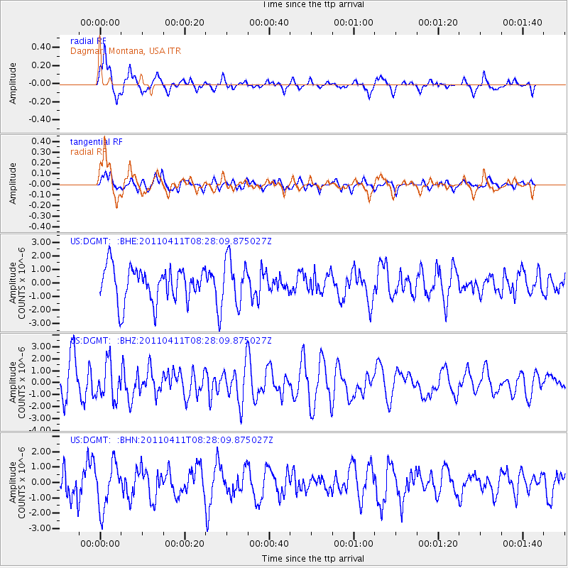
DGMT Dagmar, Montana, USA - Earthquake Result Viewer
*The percent match for this event was below the threshold and hence no stack was calculated.
| Earthquake location: |
Eastern Honshu, Japan |
| Earthquake latitude/longitude: |
37.8/140.8 |
| Earthquake time(UTC): |
2011/04/11 (101) 08:16:50 GMT |
| Earthquake Depth: |
10 km |
| Earthquake Magnitude: |
5.8 MB |
| Earthquake Catalog/Contributor: |
WHDF/NEIC |
|
| Network: |
US United States National Seismic Network |
| Station: |
DGMT Dagmar, Montana, USA |
| Lat/Lon: |
48.47 N/104.20 W |
| Elevation: |
0.0 m |
|
| Distance: |
76.5 deg |
| Az: |
38.332 deg |
| Baz: |
312.411 deg |
| Ray Param: |
$rayparam |
*The percent match for this event was below the threshold and hence was not used in the summary stack. |
|
| Radial Match: |
78.48485 % |
| Radial Bump: |
400 |
| Transverse Match: |
73.446754 % |
| Transverse Bump: |
400 |
| SOD ConfigId: |
356183 |
| Insert Time: |
2011-09-27 08:20:25.891 +0000 |
| GWidth: |
2.5 |
| Max Bumps: |
400 |
| Tol: |
0.001 |
|
Signal To Noise
| Channel | StoN | STA | LTA |
| US:DGMT: :BHZ:20110411T08:28:09.875027Z | 0.36201108 | 1.5171764E-6 | 4.190967E-6 |
| US:DGMT: :BHN:20110411T08:28:09.875027Z | 0.7519204 | 1.4624612E-6 | 1.9449683E-6 |
| US:DGMT: :BHE:20110411T08:28:09.875027Z | 1.2725013 | 1.6052647E-6 | 1.2615033E-6 |
| Arrivals |
| Ps | |
| PpPs | |
| PsPs/PpSs | |


