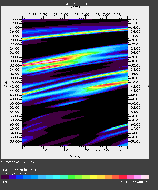
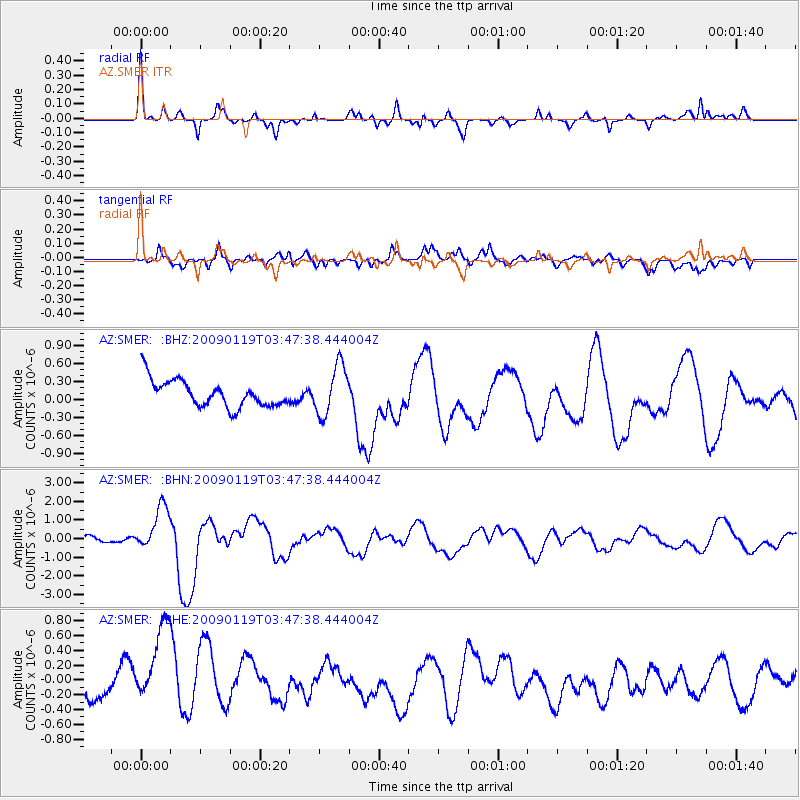
SMER AZ.SMER - Earthquake Result Viewer

Earthquake location: Southeast Of Loyalty Islands
Earthquake latitude/longitude: -22.6/170.9
Earthquake time(UTC): 2009/01/19 (019) 03:35:18 GMT
Earthquake Depth: 12 km
Earthquake Magnitude: 5.7 MB, 6.4 MS, 6.5 MW, 6.5 MW
Earthquake Catalog/Contributor: WHDF/NEIC
Network: AZ ANZA Regional Network
Station: SMER AZ.SMER
Lat/Lon: 33.46 N/117.17 W
Elevation: 355 m
Distance: 88.3 deg
Az: 52.661 deg
Baz: 241.511 deg
Ray Param: 0.042706326
Estimated Moho Depth: 29.75 km
Estimated Crust Vp/Vs: 1.73
Assumed Crust Vp: 6.264 km/s
Estimated Crust Vs: 3.615 km/s
Estimated Crust Poisson's Ratio: 0.25
Radial Match: 91.466255 %
Radial Bump: 361
Transverse Match: 52.676777 %
Transverse Bump: 400
SOD ConfigId: 2658
Insert Time: 2010-02-26 20:46:27.072 +0000
GWidth: 2.5
Max Bumps: 400
Tol: 0.001

Signal To Noise

ChannelStoNSTALTA
AZ:SMER: :BHN:20090119T03:47:38.444004Z6.20583871.2114815E-61.952164E-7
AZ:SMER: :BHE:20090119T03:47:38.444004Z3.48598436.4043377E-71.8371676E-7
AZ:SMER: :BHZ:20090119T03:47:38.444004Z1.84946074.1076913E-72.2210212E-7
Arrivals
Ps3.6 SECOND
PpPs13 SECOND
PsPs/PpSs16 SECOND