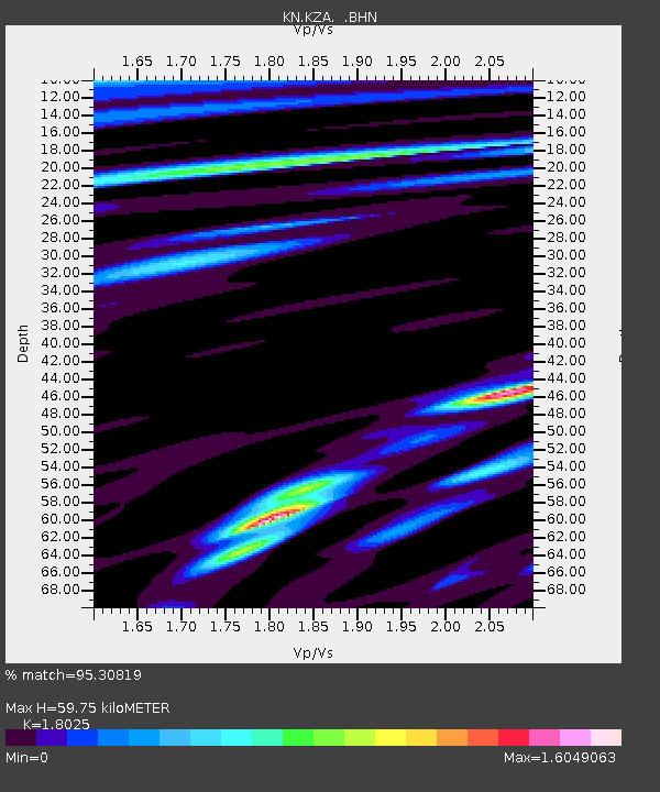
KZA KN.KZA - Earthquake Result Viewer
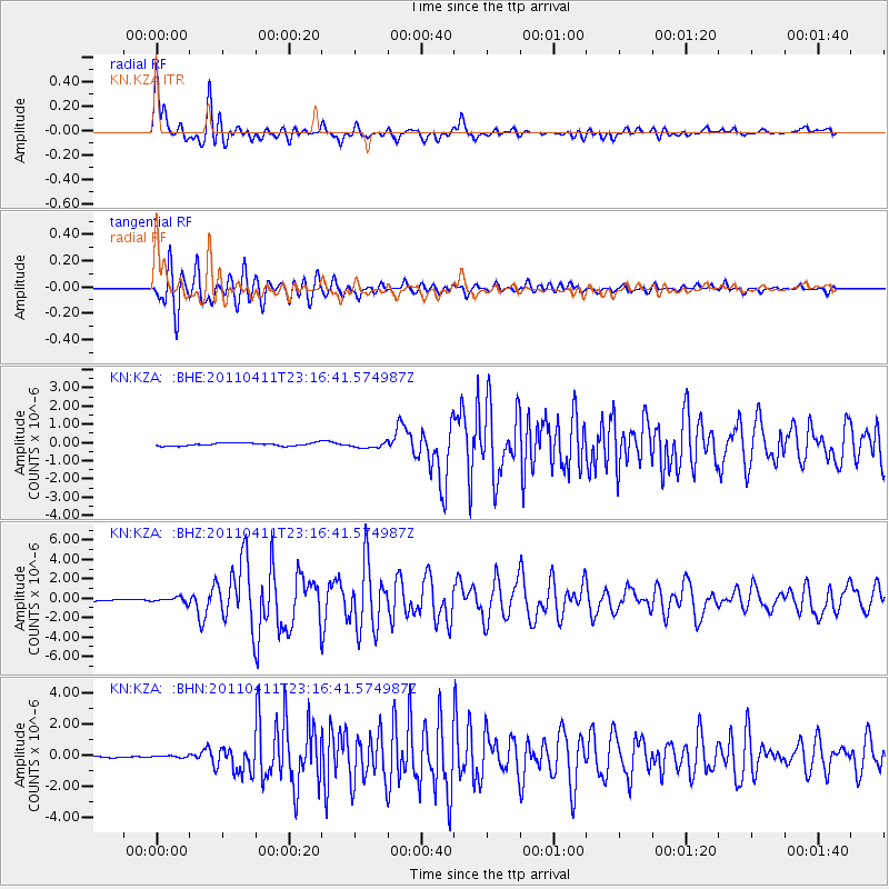
Earthquake location: Near East Coast Of Honshu, Japan
Earthquake latitude/longitude: 35.4/140.6
Earthquake time(UTC): 2011/04/11 (101) 23:08:16 GMT
Earthquake Depth: 15 km
Earthquake Magnitude: 6.0 MB, 6.1 MS, 6.2 MW, 6.2 MW
Earthquake Catalog/Contributor: WHDF/NEIC
Network: KN Kyrgyz Seismic Telemetry Network
Station: KZA KN.KZA
Lat/Lon: 42.08 N/75.25 E
Elevation: 3520 m
Distance: 50.3 deg
Az: 298.416 deg
Baz: 74.786 deg
Ray Param: 0.06815087
Estimated Moho Depth: 59.75 km
Estimated Crust Vp/Vs: 1.80
Assumed Crust Vp: 6.306 km/s
Estimated Crust Vs: 3.498 km/s
Estimated Crust Poisson's Ratio: 0.28
Radial Match: 95.30819 %
Radial Bump: 400
Transverse Match: 92.14252 %
Transverse Bump: 400
SOD ConfigId: 356183
Insert Time: 2011-09-27 09:28:30.995 +0000
GWidth: 2.5
Max Bumps: 400
Tol: 0.001

Signal To Noise

ChannelStoNSTALTA
KN:KZA: :BHZ:20110411T23:16:41.574987Z2.6392512.5851386E-79.7949716E-8
KN:KZA: :BHN:20110411T23:16:41.574987Z0.643723556.120505E-89.5079706E-8
KN:KZA: :BHE:20110411T23:16:41.574987Z1.97779691.6523727E-78.354613E-8
Arrivals
Ps8.0 SECOND
PpPs25 SECOND
PsPs/PpSs33 SECOND