
TKM2 KN.TKM2 - Earthquake Result Viewer
| ||||||||||||||||||
| ||||||||||||||||||
| ||||||||||||||||||
|
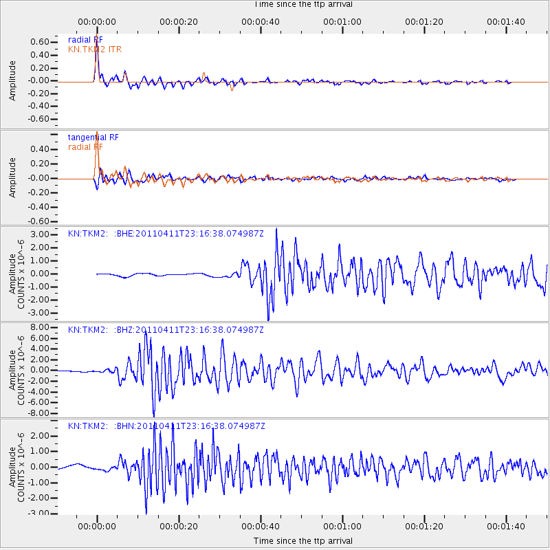
Signal To Noise
| Channel | StoN | STA | LTA |
| KN:TKM2: :BHZ:20110411T23:16:38.074987Z | 2.9852738 | 2.7432364E-7 | 9.189229E-8 |
| KN:TKM2: :BHN:20110411T23:16:38.074987Z | 1.2701194 | 1.2845028E-7 | 1.0113244E-7 |
| KN:TKM2: :BHE:20110411T23:16:38.074987Z | 1.9172806 | 1.7336654E-7 | 9.042315E-8 |
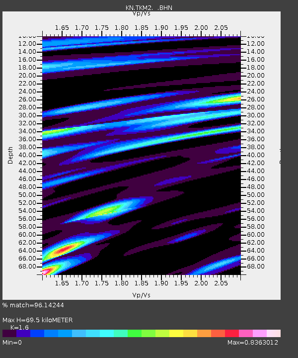
| Arrivals | |
| Ps | 7.0 SECOND |
| PpPs | 27 SECOND |
| PsPs/PpSs | 34 SECOND |

