You are here: Home > Network List > TA - USArray Transportable Network (new EarthScope stations) Stations List
> Station M04C Macdoel, CA, USA > Earthquake Result Viewer
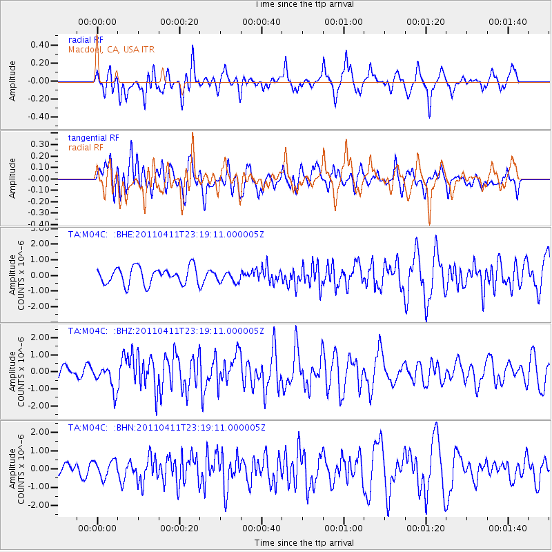
M04C Macdoel, CA, USA - Earthquake Result Viewer
*The percent match for this event was below the threshold and hence no stack was calculated.
| Earthquake location: |
Near East Coast Of Honshu, Japan |
| Earthquake latitude/longitude: |
35.4/140.6 |
| Earthquake time(UTC): |
2011/04/11 (101) 23:08:16 GMT |
| Earthquake Depth: |
15 km |
| Earthquake Magnitude: |
6.0 MB, 6.1 MS, 6.2 MW, 6.2 MW |
| Earthquake Catalog/Contributor: |
WHDF/NEIC |
|
| Network: |
TA USArray Transportable Network (new EarthScope stations) |
| Station: |
M04C Macdoel, CA, USA |
| Lat/Lon: |
41.78 N/121.84 W |
| Elevation: |
1391 m |
|
| Distance: |
72.4 deg |
| Az: |
51.055 deg |
| Baz: |
301.854 deg |
| Ray Param: |
$rayparam |
*The percent match for this event was below the threshold and hence was not used in the summary stack. |
|
| Radial Match: |
69.741905 % |
| Radial Bump: |
400 |
| Transverse Match: |
74.02853 % |
| Transverse Bump: |
400 |
| SOD ConfigId: |
356183 |
| Insert Time: |
2011-09-27 09:43:56.260 +0000 |
| GWidth: |
2.5 |
| Max Bumps: |
400 |
| Tol: |
0.001 |
|
Signal To Noise
| Channel | StoN | STA | LTA |
| TA:M04C: :BHZ:20110411T23:19:11.000005Z | 1.9509121 | 7.5655186E-7 | 3.877939E-7 |
| TA:M04C: :BHN:20110411T23:19:11.000005Z | 1.8391788 | 4.5949673E-7 | 2.4983797E-7 |
| TA:M04C: :BHE:20110411T23:19:11.000005Z | 0.6517353 | 3.500638E-7 | 5.3712574E-7 |
| Arrivals |
| Ps | |
| PpPs | |
| PsPs/PpSs | |


