You are here: Home > Network List > TA - USArray Transportable Network (new EarthScope stations) Stations List
> Station D27A Center, ND, USA > Earthquake Result Viewer
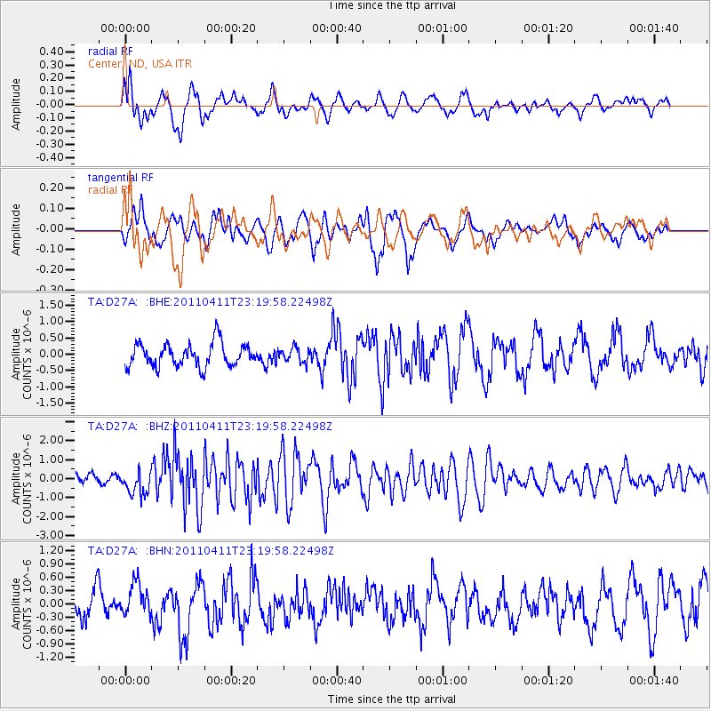
D27A Center, ND, USA - Earthquake Result Viewer
*The percent match for this event was below the threshold and hence no stack was calculated.
| Earthquake location: |
Near East Coast Of Honshu, Japan |
| Earthquake latitude/longitude: |
35.4/140.6 |
| Earthquake time(UTC): |
2011/04/11 (101) 23:08:16 GMT |
| Earthquake Depth: |
15 km |
| Earthquake Magnitude: |
6.0 MB, 6.1 MS, 6.2 MW, 6.2 MW |
| Earthquake Catalog/Contributor: |
WHDF/NEIC |
|
| Network: |
TA USArray Transportable Network (new EarthScope stations) |
| Station: |
D27A Center, ND, USA |
| Lat/Lon: |
47.11 N/101.53 W |
| Elevation: |
685 m |
|
| Distance: |
80.8 deg |
| Az: |
37.704 deg |
| Baz: |
313.004 deg |
| Ray Param: |
$rayparam |
*The percent match for this event was below the threshold and hence was not used in the summary stack. |
|
| Radial Match: |
64.50167 % |
| Radial Bump: |
400 |
| Transverse Match: |
54.442905 % |
| Transverse Bump: |
400 |
| SOD ConfigId: |
356183 |
| Insert Time: |
2011-09-27 09:56:37.709 +0000 |
| GWidth: |
2.5 |
| Max Bumps: |
400 |
| Tol: |
0.001 |
|
Signal To Noise
| Channel | StoN | STA | LTA |
| TA:D27A: :BHZ:20110411T23:19:58.22498Z | 2.7213268 | 6.364772E-7 | 2.3388489E-7 |
| TA:D27A: :BHN:20110411T23:19:58.22498Z | 1.0959319 | 3.6731686E-7 | 3.3516395E-7 |
| TA:D27A: :BHE:20110411T23:19:58.22498Z | 0.6180047 | 2.1983733E-7 | 3.5572117E-7 |
| Arrivals |
| Ps | |
| PpPs | |
| PsPs/PpSs | |


