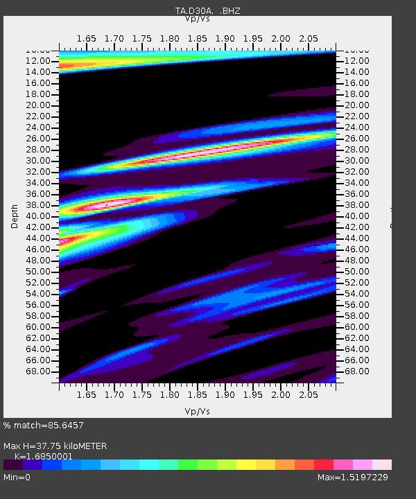
D30A Buchanan, ND, USA - Earthquake Result Viewer
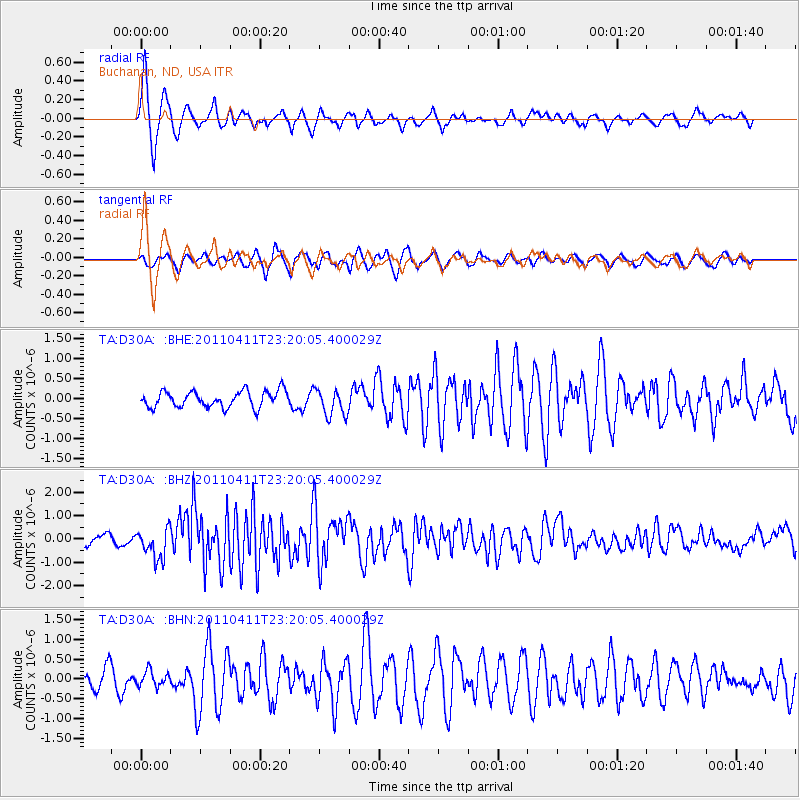
Earthquake location: Near East Coast Of Honshu, Japan
Earthquake latitude/longitude: 35.4/140.6
Earthquake time(UTC): 2011/04/11 (101) 23:08:16 GMT
Earthquake Depth: 15 km
Earthquake Magnitude: 6.0 MB, 6.1 MS, 6.2 MW, 6.2 MW
Earthquake Catalog/Contributor: WHDF/NEIC
Network: TA USArray Transportable Network (new EarthScope stations)
Station: D30A Buchanan, ND, USA
Lat/Lon: 47.11 N/98.76 W
Elevation: 465 m
Distance: 82.1 deg
Az: 36.378 deg
Baz: 314.828 deg
Ray Param: 0.047086835
Estimated Moho Depth: 37.75 km
Estimated Crust Vp/Vs: 1.69
Assumed Crust Vp: 6.53 km/s
Estimated Crust Vs: 3.876 km/s
Estimated Crust Poisson's Ratio: 0.23
Radial Match: 85.6457 %
Radial Bump: 391
Transverse Match: 71.69795 %
Transverse Bump: 400
SOD ConfigId: 356183
Insert Time: 2011-09-27 10:00:44.980 +0000
GWidth: 2.5
Max Bumps: 400
Tol: 0.001

Signal To Noise

ChannelStoNSTALTA
TA:D30A: :BHZ:20110411T23:20:05.400029Z3.6008036.460106E-71.794074E-7
TA:D30A: :BHN:20110411T23:20:05.400029Z0.72377471.9705237E-72.7225653E-7
TA:D30A: :BHE:20110411T23:20:05.400029Z1.65407543.3562634E-72.0290874E-7
Arrivals
Ps4.1 SECOND
PpPs15 SECOND
PsPs/PpSs19 SECOND