You are here: Home > Network List > TA - USArray Transportable Network (new EarthScope stations) Stations List
> Station R33A Olander Ranch, Little River, KS, USA > Earthquake Result Viewer
R33A Olander Ranch, Little River, KS, USA - Earthquake Result Viewer
*The percent match for this event was below the threshold and hence no stack was calculated.
| Earthquake location: |
Near East Coast Of Honshu, Japan |
| Earthquake latitude/longitude: |
35.4/140.6 |
| Earthquake time(UTC): |
2011/04/11 (101) 23:08:16 GMT |
| Earthquake Depth: |
15 km |
| Earthquake Magnitude: |
6.0 MB, 6.1 MS, 6.2 MW, 6.2 MW |
| Earthquake Catalog/Contributor: |
WHDF/NEIC |
|
| Network: |
TA USArray Transportable Network (new EarthScope stations) |
| Station: |
R33A Olander Ranch, Little River, KS, USA |
| Lat/Lon: |
38.31 N/97.98 W |
| Elevation: |
497 m |
|
| Distance: |
88.8 deg |
| Az: |
42.171 deg |
| Baz: |
315.812 deg |
| Ray Param: |
$rayparam |
*The percent match for this event was below the threshold and hence was not used in the summary stack. |
|
| Radial Match: |
70.969025 % |
| Radial Bump: |
400 |
| Transverse Match: |
66.249596 % |
| Transverse Bump: |
400 |
| SOD ConfigId: |
356183 |
| Insert Time: |
2011-09-27 10:11:28.913 +0000 |
| GWidth: |
2.5 |
| Max Bumps: |
400 |
| Tol: |
0.001 |
|
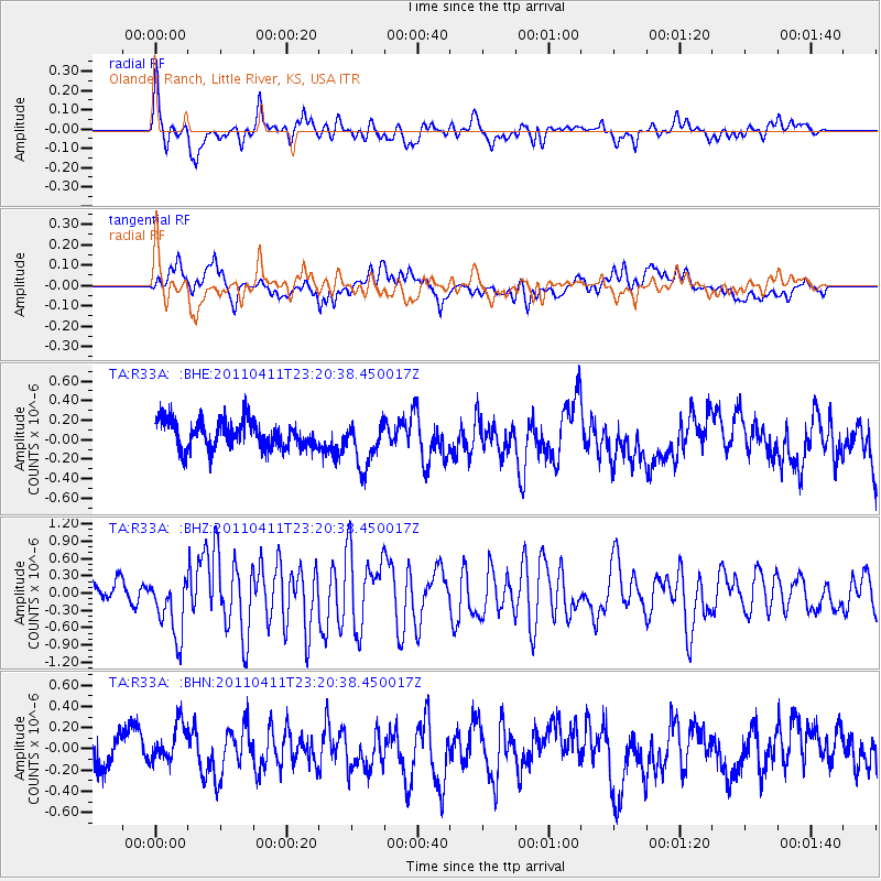
Signal To Noise
| Channel | StoN | STA | LTA |
| TA:R33A: :BHZ:20110411T23:20:38.450017Z | 3.4158602 | 5.285697E-7 | 1.5473984E-7 |
| TA:R33A: :BHN:20110411T23:20:38.450017Z | 1.1387606 | 1.8435206E-7 | 1.6188835E-7 |
| TA:R33A: :BHE:20110411T23:20:38.450017Z | 1.674991 | 2.3654721E-7 | 1.4122297E-7 |
| Arrivals |
| Ps | |
| PpPs | |
| PsPs/PpSs | |


