You are here: Home > Network List > TA - USArray Transportable Network (new EarthScope stations) Stations List
> Station M33A Taylor Creek Farms, Clarkson, NE, USA > Earthquake Result Viewer
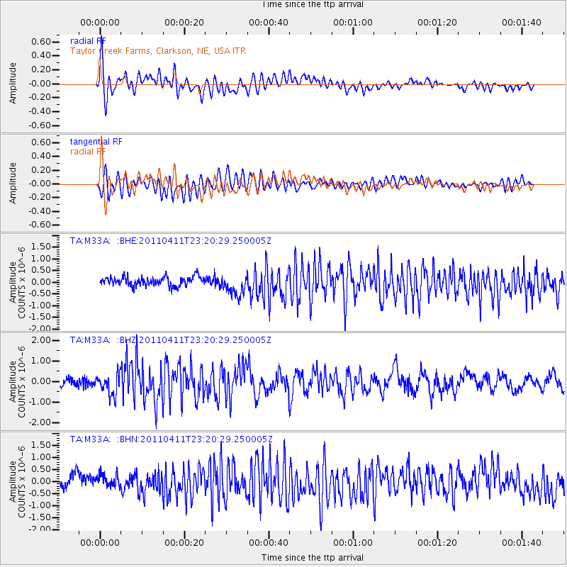
M33A Taylor Creek Farms, Clarkson, NE, USA - Earthquake Result Viewer
*The percent match for this event was below the threshold and hence no stack was calculated.
| Earthquake location: |
Near East Coast Of Honshu, Japan |
| Earthquake latitude/longitude: |
35.4/140.6 |
| Earthquake time(UTC): |
2011/04/11 (101) 23:08:16 GMT |
| Earthquake Depth: |
15 km |
| Earthquake Magnitude: |
6.0 MB, 6.1 MS, 6.2 MW, 6.2 MW |
| Earthquake Catalog/Contributor: |
WHDF/NEIC |
|
| Network: |
TA USArray Transportable Network (new EarthScope stations) |
| Station: |
M33A Taylor Creek Farms, Clarkson, NE, USA |
| Lat/Lon: |
41.57 N/97.19 W |
| Elevation: |
503 m |
|
| Distance: |
86.9 deg |
| Az: |
39.469 deg |
| Baz: |
316.214 deg |
| Ray Param: |
$rayparam |
*The percent match for this event was below the threshold and hence was not used in the summary stack. |
|
| Radial Match: |
74.86084 % |
| Radial Bump: |
400 |
| Transverse Match: |
71.577484 % |
| Transverse Bump: |
400 |
| SOD ConfigId: |
356183 |
| Insert Time: |
2011-09-27 10:39:41.179 +0000 |
| GWidth: |
2.5 |
| Max Bumps: |
400 |
| Tol: |
0.001 |
|
Signal To Noise
| Channel | StoN | STA | LTA |
| TA:M33A: :BHZ:20110411T23:20:29.250005Z | 3.4227824 | 5.150353E-7 | 1.504727E-7 |
| TA:M33A: :BHN:20110411T23:20:29.250005Z | 1.0593812 | 3.3276717E-7 | 3.1411466E-7 |
| TA:M33A: :BHE:20110411T23:20:29.250005Z | 2.4312341 | 4.6553893E-7 | 1.9148256E-7 |
| Arrivals |
| Ps | |
| PpPs | |
| PsPs/PpSs | |


