You are here: Home > Network List > AZ - ANZA Regional Network Stations List
> Station SMER AZ.SMER > Earthquake Result Viewer
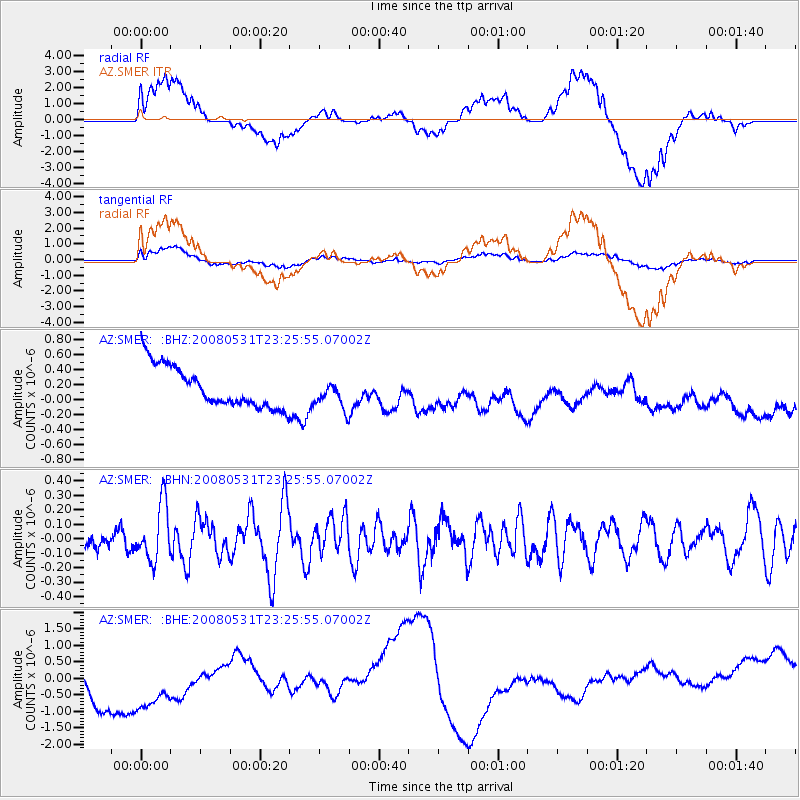
SMER AZ.SMER - Earthquake Result Viewer
*The percent match for this event was below the threshold and hence no stack was calculated.
| Earthquake location: |
Easter Island Region |
| Earthquake latitude/longitude: |
-28.9/-112.3 |
| Earthquake time(UTC): |
2008/05/31 (152) 23:16:04 GMT |
| Earthquake Depth: |
10 km |
| Earthquake Magnitude: |
5.5 MS, 5.4 MB, 5.8 MW, 5.8 MW |
| Earthquake Catalog/Contributor: |
WHDF/NEIC |
|
| Network: |
AZ ANZA Regional Network |
| Station: |
SMER AZ.SMER |
| Lat/Lon: |
33.46 N/117.17 W |
| Elevation: |
355 m |
|
| Distance: |
62.2 deg |
| Az: |
355.358 deg |
| Baz: |
175.132 deg |
| Ray Param: |
$rayparam |
*The percent match for this event was below the threshold and hence was not used in the summary stack. |
|
| Radial Match: |
65.97698 % |
| Radial Bump: |
400 |
| Transverse Match: |
53.32811 % |
| Transverse Bump: |
400 |
| SOD ConfigId: |
2504 |
| Insert Time: |
2010-02-26 20:46:55.291 +0000 |
| GWidth: |
2.5 |
| Max Bumps: |
400 |
| Tol: |
0.001 |
|
Signal To Noise
| Channel | StoN | STA | LTA |
| AZ:SMER: :BHN:20080531T23:25:55.07002Z | 2.079964 | 1.9170862E-7 | 9.216921E-8 |
| AZ:SMER: :BHE:20080531T23:25:55.07002Z | 1.3310561 | 1.4613416E-6 | 1.0978813E-6 |
| AZ:SMER: :BHZ:20080531T23:25:55.07002Z | 0.6863566 | 1.8743633E-7 | 2.7308886E-7 |
| Arrivals |
| Ps | |
| PpPs | |
| PsPs/PpSs | |


