
E31A Nome, ND, USA - Earthquake Result Viewer
| ||||||||||||||||||
| ||||||||||||||||||
| ||||||||||||||||||
|
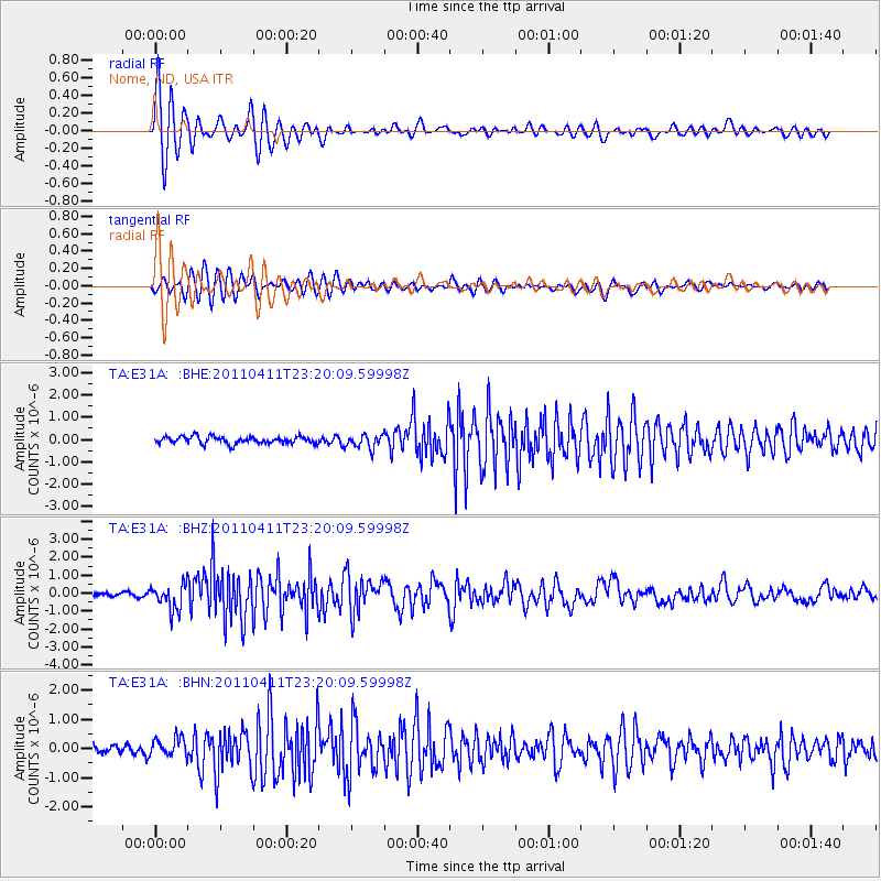
Signal To Noise
| Channel | StoN | STA | LTA |
| TA:E31A: :BHZ:20110411T23:20:09.59998Z | 6.045453 | 6.980605E-7 | 1.1546868E-7 |
| TA:E31A: :BHN:20110411T23:20:09.59998Z | 1.674897 | 3.2771197E-7 | 1.9566097E-7 |
| TA:E31A: :BHE:20110411T23:20:09.59998Z | 1.9104197 | 3.049748E-7 | 1.596376E-7 |
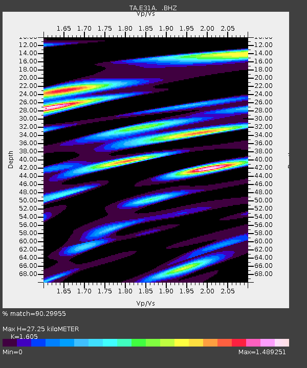
| Arrivals | |
| Ps | 2.6 SECOND |
| PpPs | 11 SECOND |
| PsPs/PpSs | 13 SECOND |

